Lyutenge
The Lyutenge (Russian: Лютенге; Yakut: Лүүтэҥкэ, obsolete "Люютэнкэ") is a river in the Sakha Republic, Russia. It is a right tributary of the Lena and has a length of 140 km (87 mi).[1]
| Lyutenge Yakut: Лүүтэҥкэ | |
|---|---|
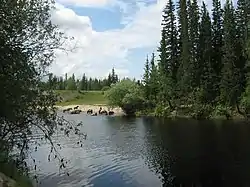 View of the river | |
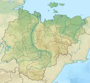 Location in the Sakha Republic, Russia | |
| Location | |
| Country | Sakha, Russia |
| Physical characteristics | |
| Source | |
| • location | Lena Plateau |
| • coordinates | 60°55′05″N 128°43′19″E |
| Mouth | Lena |
• coordinates | 61°26′32″N 129°11′33″E |
• elevation | 91 m (299 ft) |
| Length | 140 km (87 mi) |
| Basin size | 1,830 km2 (710 sq mi) |
| Basin features | |
| Progression | Lena→ Laptev Sea |
There are unusual rock formations by the river, the Turuuk Khaya Rocks, a protected area.[2]
Course
The river begins in the Byldanyany Lake, a small lake with a surface of 1 square kilometre (0.39 sq mi) located in the Lena Plateau.[3] Its upper course is in the southern part of Khangalassky District close to the A360 Lena Highway, not far from Aldan District.[4] It flows roughly southeastwards. The Lyutenge meets the right bank of the Lena by Kerdyom village, opposite the town of Pokrovsk and 1,577 km (980 mi) from the Lena's mouth.[5]
The Lyutenge River freezes between October and May. The main tributaries of the Lyutenge are the Kuon Kachah, Berdigasteheh, Kedige (Ulakhan-Kuudaly), Kuraanakh, Eselaheh and Kuuduman.[4]
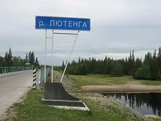 Road bridge over the river. |
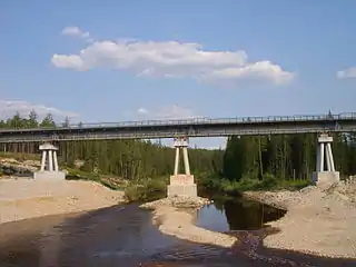 Railway bridge over the river. |
References
- Russian State Water Register - Lyutenge River
- Visit Yakutia
- Russian State Water Register - Lake Bildanyany
- Map 1: 2000000 Republic of Sakha (Yakutia), FSUE “Yakutsk Airborne Surveying Enterprise”, 2005.
- Google Earth
External links
 Media related to Lyutenge River at Wikimedia Commons
- Geography - Yakutia Organized