Mōkihinui River
The Mōkihinui River is a river located on the West Coast of New Zealand's South Island, about 40 kilometres north of Westport.[1] Meridian Energy had proposed the Mokihinui Hydro project on the river in 2007[2] but it was cancelled in May 2012. In 2019, it was announced that large parts of the river catchment, including 15 km of river bed, would be added to Kahurangi National Park.[2]
| Mōkihinui River | |
|---|---|
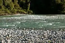 Mōkihinui River by the Rough n' Tumble Bush Lodge | |
| Location | |
| Country | New Zealand |
| Physical characteristics | |
| Mouth | |
• location | Tasman Sea |
• elevation | 0 m (0 ft) |
| Basin size | 670.36 km2 (258.83 sq mi) |
The New Zealand Ministry for Culture and Heritage gives a translation of "large flax-stalk raft" for Mōkihinui.[3] Since 2019 the official name of the river has been spelled with a macron.[4]
Geography
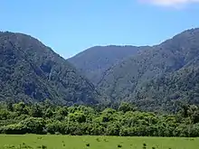
The Mōkihinui River's headwaters are located in the Glasgow Range and its mouth is on the Tasman Sea. There is little human habitation near the river: the localities of Mokihinui and Summerlea are near the river's mouth, Seddonville is a few kilometres up the river, and just prior to its terminus, State Highway 67 crosses the river outside Mokihinui. In the rugged back country behind Seddonville at the Mōkihinui Forks, the river splits into two branches, north and south.[1] The catchment of these two branches is a large inland basin of almost wholly unmodified forest.[5]
Culture
Ngāi Tahu and Ngāti Waewae are the manawhenua tribes of the area.[2]
Recreation
A tramping track called the Old Ghost Road runs along the south bank of the river giving access to Kahurangi National Park.
The river of interest for recreation and commercial whitewater activities. There is three hours of grade III water downstream from where the north and south forks meet. A river level of 1.0–1.5 metres is an optimum flow.[6]
Railway
The last few kilometres of the former Seddonville Branch railway roughly followed the Mōkihinui River near its mouth. The Branch opened on 23 February 1895 and closed on 3 May 1981, while a further extension beyond Seddonville to Mokihinui Mine closed in February 1974.[7]
During this period, the New Zealand Railways Department dumped two old steam locomotives along the river's banks between Seddonville and Mokihinui Mine to protect against erosion. The first of these locomotives, WB 292, was dumped in 1958, while sister WB 299 was dumped in January 1960. Both were recovered from the Mōkihinui River in 1989 by the Baldwin Steam Trust, and are under restoration at the Rimutaka Incline Railway.[8][9]
References
- "Place name detail: Mōkihinui River". New Zealand Gazetteer. New Zealand Geographic Board. Retrieved 23 June 2007.
- "Addition to Kahurangi National Park "largest in history of NZ"". Māori Television.
- "1000 Māori place names". New Zealand Ministry for Culture and Heritage. 6 August 2019.
- "Mōkihinui River". NZGB Gazetteer | linz.govt.nz. Retrieved 22 March 2020.
- Buller District Council, Buller District Plan: Part 3 – The Management Environment Archived 27 September 2007 at the Wayback Machine, 17, accessed 24 June 2007.
- Egarr, Graham (1988). Whitewater River Running in New Zealand. Auckland: Reed Methuen. ISBN 0-474-00302-7.
- David Leitch and Brian Scott, Exploring New Zealand's Ghost Railways, revised edition (Wellington: Grantham House, 1998 [1995]), 52-3.
- Baldwin Steam Trust, "Salvage Scheme" Archived 8 July 2007 at the Wayback Machine, accessed 23 June 2007.
- "Steam locomotive Wb 299", accessed 17 January 2017