Maloti-Drakensberg Park
Maloti-Drakensberg Park was established on 11 June 2001 by linking the Sehlabathebe National Park in the Kingdom of Lesotho and the uKhahlamba Drakensberg Park in KwaZulu-Natal, South Africa. The highest peak is Thaba Ntlenyana rising to 3.482 m.
| Maloti-Drakensberg Park | |
|---|---|
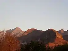
 View of mountain peaks | |
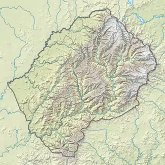 Location of the park (map of Lesotho) | |
| Location | KwaZulu-Natal, South Africa and Lesotho |
| Nearest city | Pietermaritzburg |
| Coordinates | 29°45′55″S 29°7′23″E |
| Area | 2,493 km2 (963 sq mi) |
| Includes |
|
| Criteria | Cultural and Natural: (i), (iii), (vii), (x) |
| Reference | 985bis |
| Inscription | 2000 (24th session) |
| Extensions | 2013 |
| Area | 249,313 ha (962.60 sq mi) |
| Buffer zone | 46,630 ha (180.0 sq mi) |
| Coordinates | 29°45′55″S 29°7′23″E |
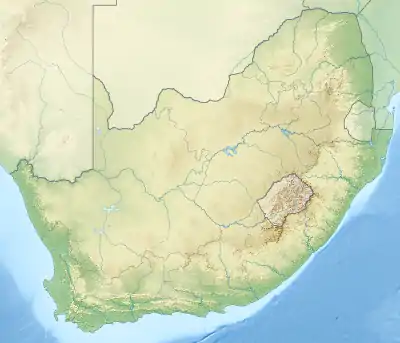 Location of the park (map of South Africa) | |
The merged park includes Golden Gate Highlands National Park, QwaQwa National Park and Sterkfontein Dam Nature Reserve, (Free State); uKhahlamba Drakensberg Park and Royal Natal National Park, (KwaZulu-Natal) and Sehlabathebe National Park, (Lesotho).
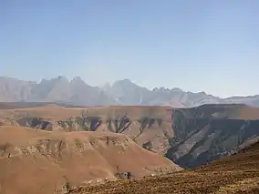
The park is situated in the Drakensberg Mountains which form the highest areas in the sub-region, and supports unique montane and sub-alpine ecosystems. These ecosystems hold a globally significant plant and animal biodiversity, with unique habitats and high levels of endemism. The park is also home to the greatest gallery of rock art in the world with hundreds of sites and many thousands of images painted by the Bushmen (San) people.
The transfrontier conservation area was conceived as a Peace park, covering about 8 113 km², made up of 5 170 km² (64%) in Lesotho and 2 943 km² (36%) in KwaZulu-Natal.