Mancera Island
Mancera Island (Spanish: Isla Mancera) is a minor island at the mouth of Valdivia River.
| Native name: Isla Mancera | |
|---|---|
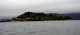 Mancera Island, view from Niebla, Chile | |
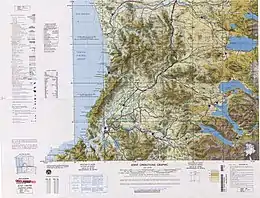 Regional map | |
| Geography | |
| Coordinates | 39°53′26″S 73°23′36″W |
| Adjacent bodies of water | Valdivia River |
| Length | 1,300 m (4300 ft) |
| Width | 650 m (2130 ft) |
| Highest point | 89 |
| Administration | |
| Region | Los Ríos |
| Province | Valdivia |
| Commune | Valdivia |
| Demographics | |
| Population | 53[1] (2002) |
Prior to being named after the Marquis of Mancera the island was known as Güiguacabin (from ühueñn, "whistle", or ühua, "maize", and cahuin, "party") to the indigenous Mapuches. In his 1544 expedition Juan Bautista Pastene, made the island known for the Spanish and named it Imperial. Later the island became known to the Spanish as Constantino after its owner Constantino Pérez, then it was known for a time it was known as Santa Ines. The name finally settled as Mancera after the Spanish viceroy of Peru Pedro de Toledo, 1st Marquis of Mancera, who ordered the fortification of the island.[2] The fort was a vital point in the Valdivian Fort System, preventing enemy ships from reaching Valdivia from Corral Bay.
In 1682, after Valdivia was badly damaged by a fire it was proposed to move the city to Mancera Island. A similar proposal of moving the city to Mancera Island was done in 1721 in order to protect it against a potential British attack as Spain and Britain were at war.[3]
See also
References
- http://www.ine.cl/canales/chile_estadistico/demografia_y_vitales/demografia/demografia.php
- Bernales Lillo, Mario (1984). "Aspectos diacrónicos en la toponimia de Valdivia". Anales de la Universidad de Chile (in Spanish). 5 (5): 79–94.
- Montt Pinto, Isabel (1971). Breve Historia de Valdivia (in Spanish). Editorial Francisco de Aguirre. p. 43. Archived from the original on 2007-02-18. Retrieved 2014-10-26.