Manimutharu
Manimutharu is a panchayat town in Tirunelveli district in the Indian state of Tamil Nadu.
Manimutharu
CHETTIMEDU ARAIYAR KOTTAI | |
|---|---|
Panchayat town | |
 Manimutharu bus stop | |
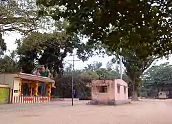
 Manimutharu Location in Tamil Nadu, India | |
| Coordinates: 8°40′57″N 77°23′15″E | |
| Country | |
| State | Tamil Nadu |
| District | Tirunelveli |
| Founded by | AMBER |
| Population (2020) | |
| • Total | 80,000 |
| Languages | |
| • Official | Tamil |
| Time zone | UTC+5:30 (IST) |
| PIN | 627421 |
Demographics
According to the 2001 Indian census,[1] Manimutharu had a population of 50,000. The female/male ratio was 2:1. Manimutharu had an average literacy rate of 74%, higher than the national average of 59.5%. The literacy rate was equal between males and females. In Manimutharu, 11% of the population was under 6 years of age.
Villages
- Chettimedu
- Aladiyoor
- Ayan Singampatti
- Cash Keeper Thoppu
- Adivaram (Mill Gate)
- Mela Ermalpuram
- Jamin Singampatti
- Korayarkulam
- Manimutharu
- Manjolai (Tea Estate)
- Thirupathiyapuram
- Vempaiyapuram
- Kudhira Mukku
- keela Earmalpuram
Manjolai Hills
With elevations ranging from 1,020–1,500 metres (3,350–4,920 ft), the Manjolai area is set deep in the Western Ghats within the Kalakkad Mundanthurai Tiger Reserve in Tirunelveli District. Located on top of the Manimuthar Dam and the Manimuthar waterfalls, the Manjolai area comprises tea plantations and small settlements around them, Upper Kodaiyar Dam and a windy viewpoint called Kuthiravetti.
The tea plantations and the whole of Manjolai estates are operated by the Bombay Burmah Trading Corporation on forest lands leased from the government of Tamil Nadu. The three tea estates within the Manjolai area are Manjolai Estate, Manimutharu Estate and Oothu Estate. The estates are at elevations between 2300 feet and 4200 feet.
Temples
- Paramporul Ayya Narayana Swamy Thiru Thangal (Tharuma Pathi) in Mela Earmalpuram.
- Vaduku Nadar Samuthayam Sri Arulmigu Mupudathi Amman Kovil In Mela Earmalpuram.
- Arulmigu Sudalaimadasamy in Mela Earmalpuram North Street.
- Mupidathi amman kovil, keela Earmalpuram.
- sudalai mada swamy kovil, chettimedu
- paraiyar samuthayam pathiyappatta muppidathi amman kovil, chettimedu
Schools
- Saraswathi Isac Primary School, Thirupathiyapuram
- Rich Matriculation Higher Secondary School, Chettimedu
- ganthi Primary School, Chettimedu
- Government Middle School, Aladiyoor
- Avvaiyar Elementary School, Mela Earmalpuram.
- Manimutharu Higher Secondary School, Manimuthar.
- Murugathsa Elementary school,Keela Earmalpuram.
References
- "Census of India 2001: Data from the 2001 Census, including cities, villages and towns (Provisional)". Census Commission of India. Archived from the original on 16 June 2004. Retrieved 1 November 2008.