Maquinchao
Maquinchao is a village and municipality in Río Negro Province in Argentina.[1]
Maquinchao | |
|---|---|
 Plaza Sarmiento, Maquinchao | |
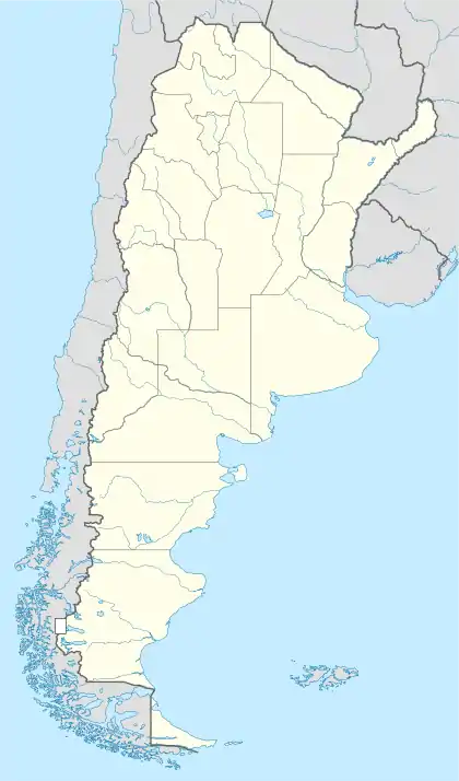 Maquinchao Location of Maquinchao in Argentina | |
| Coordinates: 41°15′S 68°42′W | |
| Country | |
| Province | Río Negro Province |
| Department | Veinticinco de Mayo Department, Río Negro |
| Elevation | 888 m (2,913 ft) |
| Population (2010) | |
| • Total | 2,494 |
| Climate | BSk |
Climate
This town is located in the middle of northern Patagonia, right in the steppe. Consequently, the climate is cold semi-arid (BSk, according to the Köppen climate classification, bordering on a cold desert climate — BWk) and it can be quite extreme: temperatures can range from well above 35 °C (95 °F) on the hottest summer days (but with cold, desert nights at around 10 °C or 50 °F) to lows that might reach −35 °C (−31 °F). Usually, summer days average 26 °C (79 °F) and nights 8 °C (46 °F), whereas winter days average 6 °C (42 °F) and nights, −5 °C (23 °F). Snow is common, but since precipitation is generally low, quantities tend to be reduced. The weather is generally windy, especially in the spring.
| Climate data for Maquinchao (1981–2010, extremes 1941–present)[lower-alpha 1] | |||||||||||||
|---|---|---|---|---|---|---|---|---|---|---|---|---|---|
| Month | Jan | Feb | Mar | Apr | May | Jun | Jul | Aug | Sep | Oct | Nov | Dec | Year |
| Record high °C (°F) | 38.9 (102.0) |
37.0 (98.6) |
36.0 (96.8) |
30.0 (86.0) |
24.0 (75.2) |
21.0 (69.8) |
18.0 (64.4) |
22.0 (71.6) |
28.0 (82.4) |
31.0 (87.8) |
35.6 (96.1) |
37.0 (98.6) |
38.9 (102.0) |
| Average high °C (°F) | 26.4 (79.5) |
25.7 (78.3) |
21.9 (71.4) |
16.3 (61.3) |
10.9 (51.6) |
6.6 (43.9) |
6.2 (43.2) |
9.2 (48.6) |
12.9 (55.2) |
16.9 (62.4) |
20.9 (69.6) |
24.2 (75.6) |
16.5 (61.7) |
| Daily mean °C (°F) | 18.0 (64.4) |
17.5 (63.5) |
14.1 (57.4) |
8.9 (48.0) |
4.4 (39.9) |
1.4 (34.5) |
0.5 (32.9) |
2.7 (36.9) |
5.7 (42.3) |
9.8 (49.6) |
13.5 (56.3) |
16.6 (61.9) |
9.4 (48.9) |
| Average low °C (°F) | 9.3 (48.7) |
9.1 (48.4) |
6.6 (43.9) |
2.3 (36.1) |
−0.6 (30.9) |
−2.9 (26.8) |
−4.6 (23.7) |
−3.1 (26.4) |
−1.1 (30.0) |
2.3 (36.1) |
5.4 (41.7) |
7.9 (46.2) |
2.6 (36.7) |
| Record low °C (°F) | −3.4 (25.9) |
−3.7 (25.3) |
−6.5 (20.3) |
−12.2 (10.0) |
−18.3 (−0.9) |
−25.6 (−14.1) |
−24.5 (−12.1) |
−19.1 (−2.4) |
−14.5 (5.9) |
−10.8 (12.6) |
−6.5 (20.3) |
−5.9 (21.4) |
−25.6 (−14.1) |
| Average precipitation mm (inches) | 12.4 (0.49) |
14.7 (0.58) |
20.1 (0.79) |
14.8 (0.58) |
26.2 (1.03) |
16.3 (0.64) |
20.1 (0.79) |
12.8 (0.50) |
11.6 (0.46) |
12.8 (0.50) |
12.8 (0.50) |
13.8 (0.54) |
188.2 (7.41) |
| Average rainfall mm (inches) | 12.4 (0.49) |
14.7 (0.58) |
20.1 (0.79) |
14.5 (0.57) |
25.2 (0.99) |
15.3 (0.60) |
17.1 (0.67) |
10.8 (0.43) |
10.6 (0.42) |
12.1 (0.48) |
12.8 (0.50) |
13.8 (0.54) |
179.4 (7.06) |
| Average snowfall cm (inches) | 0.0 (0.0) |
0.0 (0.0) |
0.0 (0.0) |
0.1 (0.0) |
1.0 (0.4) |
1.0 (0.4) |
3.0 (1.2) |
2.0 (0.8) |
1.0 (0.4) |
0.7 (0.3) |
0.0 (0.0) |
0.0 (0.0) |
8.8 (3.5) |
| Average rainy days | 2.8 | 2.4 | 3.4 | 3.6 | 5.2 | 5.6 | 5.2 | 4.8 | 4.2 | 3.8 | 2.4 | 2.8 | 46.2 |
| Average snowy days | 0.0 | 0.0 | 0.0 | 0.1 | 0.3 | 3.0 | 2.0 | 1.0 | 0.9 | 0.0 | 0.0 | 0.0 | 7.3 |
| Average relative humidity (%) | 42.8 | 46.9 | 52.7 | 59.6 | 67.1 | 72.0 | 69.5 | 64.5 | 58.1 | 52.3 | 47.6 | 44.8 | 56.5 |
| Source 1: Servicio Meteorológico Nacional[2] | |||||||||||||
| Source 2: Instituto Nacional de Tecnología Agropecuaria (precipitation, rainfall, snow, and extremes 1941–1990),[3] Oficina de Riesgo Agropecuario (extremes 1970–present)[4][5] | |||||||||||||
References
- Ministerio del Interior (in Spanish)
- "Estadísticas Climatológicas Normales - período 1981-2010" (in Spanish). Servicio Meteorológico Nacional. Retrieved January 18, 2018.
- Bustos, José; Rocchi, Victor. "Caracterizacíon Termopluviométrica de Algunas Estaciones Meteorológicas de Rio Negro Y Neuquén" (PDF) (in Spanish). Instituto Nacional de Tecnología Agropecuaria. p. 4. Retrieved April 6, 2015.
- "Maquinchao, Rio Negro". Estadísticas meteorológicas decadiales (in Spanish). Oficina de Riesgo Agropecuario. Retrieved March 25, 2016.
- "87774: Maquinchao (Argentina)". OGIMET. 23 January 2021. Retrieved 23 January 2021.
Notes
- The record highs and lows are based on the INTA link for the period 1941–1990 while records beyond 1990 come from the Oficina de Riesgo Agropecuario link since it only covers from 1970–present. As such, the extremes span a period from 1941–present when these 2 sources are used together