Maryland Route 638
Maryland Route 638 (MD 638) is a state highway in the U.S. state of Maryland. Known as Parkersburg Road, the state highway runs 2.34 miles (3.77 km) from MD 743 in Eckhart Mines north to MD 36 near Mount Savage in northwestern Allegany County. MD 638 was constructed in the late 1930s.
| ||||
|---|---|---|---|---|
| Parkersburg Road | ||||
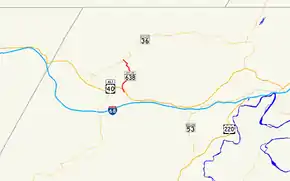 Maryland Route 638 highlighted in red | ||||
| Route information | ||||
| Maintained by MDSHA | ||||
| Length | 2.34 mi[1] (3.77 km) | |||
| Existed | 1938–present | |||
| Major junctions | ||||
| South end | ||||
| North end | ||||
| Location | ||||
| Counties | Allegany | |||
| Highway system | ||||
| ||||

Route description
_at_Maryland_State_Route_36_(Mount_Savage_Road)_in_Morantown%252C_Allegany_County%252C_Maryland.jpg.webp)
MD 638 begins at an oblique intersection with unsigned MD 743 (Old National Pike) in Eckhart Mines. The state highway crosses Porter Run on a narrow bridge before meeting U.S. Route 40 Alternate (National Pike). MD 638 continues north as a two-lane undivided road and ascends the side of Federal Hill. At Porter Cemetery Hill, the state highway turns northwest and descends into the valley of Jennings Run. MD 638 passes through two sharp S-curves on either side of a 15-foot-wide (4.6 m) bridge over the Western Maryland Scenic Railroad. The state highway reaches its northern terminus at MD 36 (Mount Savage Road) between Mount Savage and Zihlman near the hamlets of Morantown and Slabtown.[1][2]
History
MD 638 was constructed in its modern form in 1938.[3]
Junction list
The entire route is in Allegany County.
| Location | mi[1] | km | Destinations | Notes | |
|---|---|---|---|---|---|
| Eckhart Mines | 0.00 | 0.00 | Southern terminus; MD 743 is unsigned | ||
| 0.21 | 0.34 | ||||
| | 2.34 | 3.77 | Northern terminus | ||
| 1.000 mi = 1.609 km; 1.000 km = 0.621 mi | |||||
See also
 Maryland Roads portal
References
- Highway Information Services Division (December 31, 2013). Highway Location Reference. Maryland State Highway Administration. Retrieved 2010-11-04.
- Allegany County (PDF).
- Google (2010-03-07). "Maryland Route 638" (Map). Google Maps. Google. Retrieved 2010-03-07.
- Maryland State Roads Commission (1938). Map of Maryland Showing State Road System (Map). Baltimore: Maryland State Roads Commission.
External links
| Wikimedia Commons has media related to Maryland Route 638. |