Mayo River (Dan River tributary)
The Mayo River is a tributary of the Dan River, which in turn is a tributary of the Roanoke River. All three rivers flow through the U.S. states of Virginia and North Carolina. It is named for Major William Mayo (ca. 1685-1744).
| Mayo River Tributary to Dan River | |
|---|---|
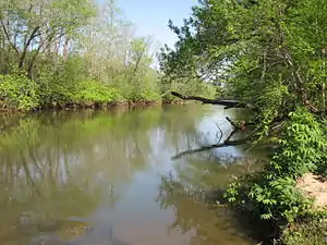
 Mayo River at US 220 access | |
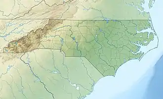
 Location of Mayo River mouth  Mayo River (Dan River tributary) (the United States) | |
| Location | |
| Country | United States |
| State | North Carolina |
| County | Rockingham |
| City | Mayodan |
| Physical characteristics | |
| Source | confluence of North and South Mayo Rivers |
| • location | about 6 miles northeast of Ayersville, North Carolina |
| • coordinates | 36°32′25″N 078°59′21″W[1] |
| • elevation | 698 ft (213 m)[2] |
| Mouth | Dan River |
• location | Madison, North Carolina |
• coordinates | 36°23′24″N 078°57′07″W[1] |
• elevation | 538 ft (164 m)[2] |
| Length | 15.58 mi (25.07 km)[3] |
| Basin size | 317.50 square miles (822.3 km2)[4] |
| Discharge | |
| • location | Mayodan River |
| • average | 416.64 cu ft/s (11.798 m3/s) at mouth with Dan River[4] |
| Basin features | |
| Progression | south-southeast |
| River system | Dan River |
| Tributaries | |
| • left | Buffalo Creek Hickory Creek |
| • right | Pawpaw Creek |
| Bridges | Anglin Mill Road, T. Clarence Stone Highway, US 220, JJ Webster Highway, Dan Valley Road |
Course
The Mayo River is formed by two main branches, the North Fork Mayo River and the South Fork Mayo River. Both forks rise in Patrick County, Virginia, gathering the waters of many tributary streams. The two forks join in northwestern Rockingham County, North Carolina, forming the Mayo River proper, which then flows south into joining the Dan River near the towns of Mayodan, North Carolina and Madison, North Carolina.
References
- "GNIS Detail - Mayo River". geonames.usgs.gov. US Geological Survey. Retrieved 16 October 2019.
- "Mayo River Topo Map, Rockingham County NC (Mayodan Area)". TopoZone. Locality, LLC. Retrieved 16 October 2019.
- "ArcGIS Web Application". epa.maps.arcgis.com. US EPA. Retrieved 16 October 2019.
- "Mayo River Watershed Report". Waters Geoviewer. US EPA. Retrieved 16 October 2019.
This article is issued from Wikipedia. The text is licensed under Creative Commons - Attribution - Sharealike. Additional terms may apply for the media files.