Mazabuka
Mazabuka is a town in the Southern Province of Zambia. It is the capital of Mazabuka District, one of the thirteen administrative units in the Southern Province. The name Mazabuka originates from a Tonga local language word "Twazabuka" or "Kuzabuka" which means "To cross over the river". It is believed that the name was coined after the Tonga people crossed the Magoye River during their migrations.[1]
Mazabuka | |
|---|---|
City | |
 Mazabuka | |
| Coordinates: 15°50′48″S 27°44′51″E | |
| Country | Zambia |
| Province | Southern Province |
| District | Mazabuka District |
| City | Mazabuka Municipality |
| Elevation | 1,067 m (3,501 ft) |
| Population (2010) | |
| • Total | 71,700 |
| Census | |
| Time zone | UTC+2 (CAT) |
| Climate | Cwa |
Location
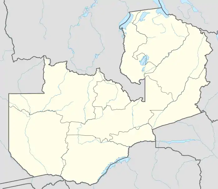
The town is located in Mazabuka District, in Zambia's Southern Province. The town lies on the south east edge of the Kafue Flats wetland, along the Lusaka–Livingstone Road. It is approximately 135 kilometres (84 mi), by road southwest of Lusaka, the national capital and largest city.[2] The geographical coordinates of Mazabuka are:15°50'48.0"S, 27°44'51.0"E (Latitude:-15.846667; Longitude:27.747500).[3] Mazabuka sits at an average elevation of 1,067 metres (3,501 ft) above mean sea level.[4]
Overview
The town has grown around sugar cane plantations, and currently it hosts the headquarters of Zambia Sugar, the largest sugar-manufacturing company in Zambia, with annual output in excess of 318,467 tonnes (351,050 tons) of crystalline sugar annually.[5]
Population
In 1990, the city had 24,596 people. In 2000, the town's population was 47,148 people. During the 2010 national census and household population survey, the city had 71,700 inhabitants.[6] The table below illustrates the same data in tabular format.
| Year | Population |
|---|---|
| 1990 | 24,596[6] |
| 2000 | 47,148[6] |
| 2010 | 71,700[6] |
Transport
Mazabuka is also connected to Lusaka and Livingstone, by railway.[7][8]
Education
Musikili Primary School is a private boarding school for children between 5 and 13 years old. Flamboyant School, is a school for children with disabilities and is located on the outskirts of the town. It is operated by the Mazabuka Association for the Disabled.[9]
Healthcare
Mazabuka is home to (a) Mazabuka Sugar Hospital for the management and staff of Zambia Sugar Plc[10] and (b) Mazabuka General Hospital for the general public.[11]
References
- Wilma S. Nchito (April 2010). "Migratory patterns in small towns: The cases of Mazabuka and Kalomo in Zambia". Environment & Urbanization. Sage Publications. p. 91–105. doi:10.1177/0956247810362846.
- Google (25 May 2020). "Road Distance Between Lusaka And Mazabuka" (Map). Google Maps. Google. Retrieved 25 May 2020.
- Google (25 May 2020). "Location of Mazabuka, Zambia" (Map). Google Maps. Google. Retrieved 25 May 2020.
- Flood Map (25 May 2020). "Elevation of Mazabuka, Zambia". Floodmap.net. Retrieved 25 May 2020.
- African Financials (12 November 2018). "Zambia Sugar averages 120 tons cane per hectare in FY`18". Africanfinancials.com. Retrieved 25 May 2020.
- Central Statistical Office Zambia and City Population (14 July 2019). "Population of Zambian Cities and Urban Centres: Mazabuka". Citypopulation.de. Retrieved 28 May 2020.
- Romeo2Rio (25 May 2020). "Mazabuka–Lusaka By Rail". Romeo2rio.com. Retrieved 25 May 2020.
- Zambia Railways (25 May 2020). "Zambia Railways Limited". Lusaka: Zambia Railways. Retrieved 25 May 2020.
- Mazabuka Association for the Disabled (25 May 2020). "About Mazabuka Association for the Disabled". Mazabuka, Zambia: Mazabuka Association for the Disabled. Retrieved 25 May 2020.
- Illovo Sugar (17 June 2014). "Njomona Clinic Becomes 'Zambia Sugar Hospital'". Durban, South Africa: Illovo Sugar Archives. Retrieved 25 May 2020.
- Daniel Banda (21 February 2018). "CIDRZ Renovates Mazabuka General Hospital & Chongwe Urban Clinic Laboratories". Lusaka: Centre for Infectious Diseases Research in Zambia (CIDRZ). Retrieved 25 May 2020.
External links
- Zambia: Mazabuka has more sugar cane than people As at 2 February 1998.