McAllister Glacier
McAllister Glacier is in a large cirque to the north and east of Dorado Needle, North Cascades National Park, in the U.S. state of Washington.[2] The glacier is approximately 1.85 mi (2.98 km) in length, 1.5 mi (2.4 km) in width at its terminus and descends from 8,000 to 4,500 ft (2,400 to 1,400 m), where it terminates near a proglacial lake. McAllister Glacier is nearly connected to Inspiration Glacier to the south and the two glaciers are separated by the arête known as Tepeh Towers. Klawatti Peak and an arete extending north from that peak separate McAllister Glacier from the Klawatti Glacier to the east.[2] Satellite imagery indicates that between 1998 and 2006, McAllister Glacier retreated more than 500 ft (150 m).
| McAllister Glacier | |
|---|---|
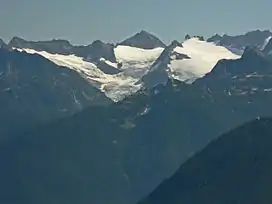 McAllister Glacier in 2007 | |
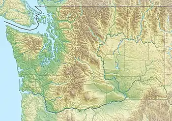 McAllister Glacier Location in Washington | |
| Type | Mountain glacier |
| Location | North Cascades National Park, Skagit County, Washington, U.S. |
| Coordinates | 48°33′24″N 121°07′49″W[1] |
| Length | 1.85 mi (2.98 km) |
| Terminus | Icefall |
| Status | Retreating |
McAllister Glacier
References
- "McAllister Glacier". Geographic Names Information System. United States Geological Survey. Retrieved 2013-02-09.
- Eldorado Peak, WA (Map). TopoQwest (United States Geological Survey Maps). Retrieved 2013-02-09.
This article is issued from Wikipedia. The text is licensed under Creative Commons - Attribution - Sharealike. Additional terms may apply for the media files.