Mergie
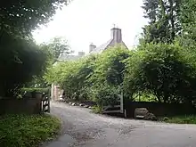
Mergie is a settlement in Aberdeenshire approximately six miles west of Stonehaven, Scotland.[1] Situated in the former Kincardineshire slightly south of the Slug Road.
Early area history
Mergie is in an area of significant prehistoric and historic fabric. Roman legions marched from Raedykes to Normandykes Roman Camp on a route not far from Mergie as they sought higher ground evading the bogs of Red Moss and other low-lying mosses associated with the Burn of Muchalls. That march used the Elsick Mounth, one of the ancient trackways crossing the Mounth of the Grampian Mountains,[2] lying west of Netherley.
References
- United Kingdom Ordnance Survey Map Landranger 45, Stonehaven and Banchory, 1:50,000 scale, 2004
- C. Michael Hogan, Elsick Mounth, Megalithic Portal, editor: A. Burnham (2007)
| Wikimedia Commons has media related to Mergie. |
This article is issued from Wikipedia. The text is licensed under Creative Commons - Attribution - Sharealike. Additional terms may apply for the media files.