Meythet
Meythet is a former commune in the Haute-Savoie department in the Auvergne-Rhône-Alpes region in south-eastern France. On 1 January 2017, it was merged into the commune Annecy.[2]
Meythet | |
|---|---|
Part of Annecy | |
 The town hall in Meythet | |
Location of Meythet 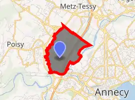
| |
 Meythet  Meythet | |
| Coordinates: 45°54′56″N 6°05′37″E | |
| Country | France |
| Region | Auvergne-Rhône-Alpes |
| Department | Haute-Savoie |
| Arrondissement | Annecy |
| Canton | Annecy-1 |
| Commune | Annecy |
| Area 1 | 3.24 km2 (1.25 sq mi) |
| Population (2017)[1] | 8,424 |
| • Density | 2,600/km2 (6,700/sq mi) |
| Demonym(s) | Meythésan / Meythésane |
| Time zone | UTC+01:00 (CET) |
| • Summer (DST) | UTC+02:00 (CEST) |
| Postal code | 74960 |
| Elevation | 411–460 m (1,348–1,509 ft) |
| Website | www.mairie-meythet.fr |
| 1 French Land Register data, which excludes lakes, ponds, glaciers > 1 km2 (0.386 sq mi or 247 acres) and river estuaries. | |
Geography
The Fier forms most of the commune's south-eastern border.
References
- Téléchargement du fichier d'ensemble des populations légales en 2017, INSEE
- Arrêté préfectoral 14 July 2016 (in French)
| Wikimedia Commons has media related to Meythet. |
| Authority control |
|---|
This article is issued from Wikipedia. The text is licensed under Creative Commons - Attribution - Sharealike. Additional terms may apply for the media files.