Miramshah
Mīrāmshāh (Pashto/Urdu: ميرامشا) or Mīrānshāh (ميرانشاه) is a small town that is the administrative headquarters of North Waziristan, Pakistan. Miramshah lies on the banks of the Tochi River in a wide valley surrounded by the foothills of the Hindu Kush mountains. It is located at an elevation of about 930 metres (3,050 ft), 17 kilometres (11 mi) from the Pakistan-Afghanistan border (Durand Line). The nearest city in Pakistan is Bannu, about 55 kilometres (34 mi) to the east, while the nearest city across the border in Afghanistan is Khost, 60 kilometres (37 mi) to the northwest.
Miramshah
ميرامشا | |
|---|---|
City | |
 Miramshah  Miramshah | |
| Coordinates: 33°0′9″N 70°4′8″E | |
| Country | |
| Province | |
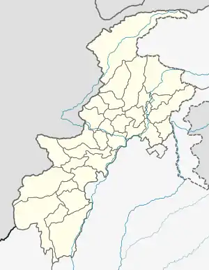
| Agency | North Waziristan |
| Tehsil | Miran Shah |
| Elevation | 930 m (3,050 ft) |
| Population | |
| • Total | 4,361 |
| Time zone | UTC+5 (PST) |
The city is an extremely tiny city with a shrinking population of and only 4,361, and it has only 356 households.[1] This makes it the least populous urban area in Bannu Division, but it is also the only urbanized area in the entire region of North Waziristan, and also the entire Waziristan region, a mountainous area that has 99% of its 1.22 million residents living in rural areas.
Administration
Miramshah is the administrative headquarters of North Waziristan District, in the former Federally Administered Tribal Areas of Pakistan (FATA). In 2018, FATA was merged into the Khyber Pakhtunkhwa province of Pakistan.
History
| Year | Pop. | ±% p.a. |
|---|---|---|
| 1972 | 3,797 | — |
| 1998 | 5,965 | +1.75% |
| 2017 | 4,361 | −1.63% |
| Source: [2][1] | ||
_Band%252C_Miran_Shah_1917.jpg.webp)
Miramshah was named after the Timurid ruler, Miran Shah, the son of Timur.
In 1905, the British constructed Miramshah Fort to control North Waziristan.
In the early 1950s, the Pakistan Air Force (PAF) and the "Tochi Scouts" of Pakistan's paramilitary Frontier Corps carried out counter-insurgency operations from Miramshah Airfield and Miramshah Fort against the insurgency fomented by the rebellious General Shudikhel Dawar and Mirzali Khan (Faqir of Ipi). In the 1950s, Miramshah was also the site of a weapons firing range of the PAF, which was located next to the Miramshah Airfield.[3]
After 9/11, Miramshah gained prominence in the United States-led War on Terror and has witnessed numerous drone strikes by the US Central Intelligence Agency targeting alleged militants hiding in the town and in the surrounding foothills.[4] Miramshah and its surrounding areas have also witnessed fighting between militants and Pakistani military and paramilitary forces.
Notable places
Miramshah has a historical fort built by the British in 1905, which, since Pakistan's independence on 14 August 1947, has been used as a garrison by the "Tochi Scouts" of Pakistan's Frontier Corps. The town also has a 7,000 ft. long airfield, which is used for both civil and military purposes.
Other notable places include a bazaar, a sports stadium, a primary school, a secondary school and a college.
References
- "POPULATION AND HOUSEHOLD DETAIL FROM BLOCK TO DISTRICT LEVEL FATA (NORTH WAZIRISTAN AGENCY)" (PDF). NORTH_WAZIRISTAN_AGENCY_BLOCKWISE.pdf. Pakistan Bureau of Statistics. 3 January 2018. Archived from the original (PDF) on 10 July 2020. Retrieved 20 June 2020.
- "TABLE-1: AREA & POPULATION OF ADMINISTRATIVE UNITS BY RURAL/URBAN: 1951-1998 CENSUSES" (PDF). Administrative Units.pdf. Pakistan Bureau of Statistics. Archived (PDF) from the original on 20 June 2020. Retrieved 20 June 2020.
- Pike, John. "14 Squadron". Globalsecurity.org. Retrieved 2013-07-03.
- "4 militants killed in US drone strike in Miranshah". Pakistan Today. Nawa Media Corporation. 2012-04-29. Retrieved 2013-07-03.
External links
| Wikimedia Commons has media related to Miran Shah. |