Monte Meta
Monte Meta (or simply La Meta[2]) is a mountain of the Apennine Mountains, in central Italy.
| Monte Meta | |
|---|---|
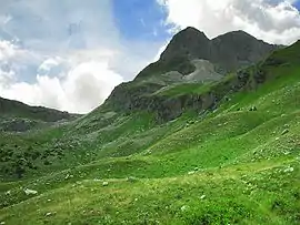 View from Valle Pagana | |
| Highest point | |
| Elevation | 2,241 m (7,352 ft) [1] |
| Coordinates | 41°41′19.68″N 13°56′23.35″E |
| Geography | |
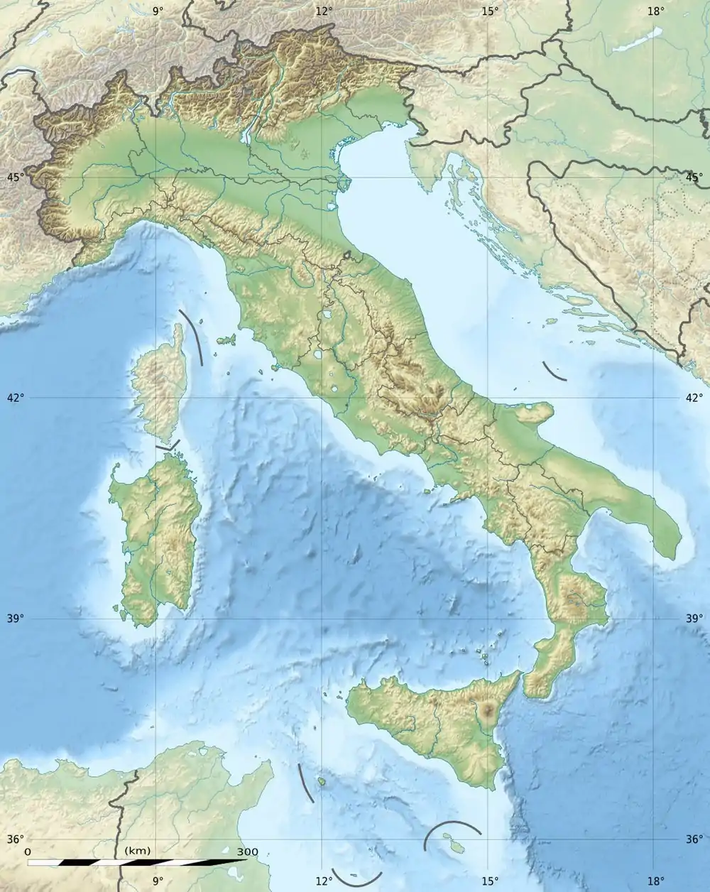 Monte Meta Location in Italy | |
| Location | Molise, Lazio, Abruzzo - Italy |
| Parent range | Monti della Meta |
| Climbing | |
| Easiest route | Hike |
Geography
The mountain is part of the Monti della Meta range and lies in the Parco Nazionale d'Abruzzo, Lazio e Molise. It includes a tripoint where the Italian regions of Lazio, Abruzzo and Molise meet; concerned comuni are Alfedena (AQ), Picinisco (FR) and Pizzone (IS).[3] The tripoint is located on its western sub-summit, at 2185 m, which is also the highest point of Molise.[2]
Toponymy
More than Monte Meta (masculine) the mountain is usually called in the spoken language la Meta (feminine);[4] it gives the name to the Monti della Meta, an Apennine sub-range.
Access to the summit
Due to an important population of Rupicapra pyrenaica ssp. ornata living on the mountain, the access to the area is strictly regulated in order to reduce disturbance. A single footpath (named L1) is accessible to hikers during the summer. Also the days of the week for hikes and the number of hikers admitted per day are fixed, and a previous authorization must be requested to the natural park administration.[5]
Notes
- Barnes, Adriano (1987). Abruzzo con lo zaino. Edizioni Mediterranee. p. 155. Retrieved 2016-07-15.
- "Italy Region High Points". Retrieved 2016-07-15.
- Carta 1:25.00, Istituto Geografico Militare (on-line:www.pcn.minambiente.it)
- "Sentiero di accesso al Monte Meta". Parco Nazionale Abruzzo, Lazio e Molise. Retrieved 2016-07-16.
- "MONTE META A NUMERO CHIUSO DAL 13 AGOSTO AL 5 SETTEMBRE". www.prolocoalfedena.org. Pro Loco di Alfedena. Archived from the original on 2016-08-14. Retrieved 2016-07-16.
External links
![]() Media related to Monte Meta at Wikimedia Commons
Media related to Monte Meta at Wikimedia Commons