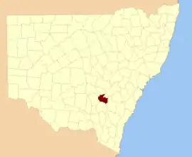
Monteagle County

Monteagle County is one of the 141 Cadastral divisions of New South Wales.

Monteagle
New South Wales
Location in New South Wales
Lands administrative divisions around Monteagle:
Bland Forbes Bathurst
Bland Monteagle King
Harden Harden King

Monteagle County was named in honour of Thomas Spring Rice, 1st Baron Monteagle of Brandon (1790-1866), a former Chancellor of the Exchequer.[1]

Parishes within this county

A full list of parishes found within this county; their current LGA and mapping coordinates to the approximate centre of each location is as follows:

ParishLGACoordinates
BaxterHilltops Council34°17′54″S 148°12′04″E
Bendick MurrellHilltops Council34°03′54″S 148°29′04″E
BribbareeHilltops Council34°13′05″S 148°04′45″E
BrundahWeddin Shire33°54′54″S 148°11′04″E
BumbaldryWeddin Shire33°54′54″S 148°30′04″E
BungalongWeddin Shire33°59′54″S 148°20′04″E
BungalongWeddin Shire34°00′54″S 148°20′04″E
BurramundaHilltops Council34°08′54″S 148°13′04″E
BurrangongHilltops Council34°14′54″S 148°15′04″E
CobaWeddin Shire33°59′54″S 148°15′04″E
CocominglaHilltops Council34°01′54″S 148°47′04″E
CongeraHilltops Council34°17′54″S 148°43′04″E
CoolegongHilltops Council34°05′54″S 148°14′04″E
CudgymaguntryWeddin Shire33°59′54″S 148°25′04″E
DananbillaHilltops Council34°14′54″S 148°27′04″E
GeegullalongHilltops Council34°23′54″S 148°38′04″E
GungewallaHilltops Council34°18′54″S 148°37′04″E
IandraWeddin Shire34°02′54″S 148°20′04″E
IllunieHilltops Council34°06′54″S 148°30′04″E
KikiamahHilltops Council34°04′54″S 148°04′04″E
MarinaHilltops Council34°19′54″S 148°24′04″E
Murringo NorthHilltops Council34°14′54″S 148°30′04″E
MurringoHilltops Council34°14′54″S 148°30′04″E
MurrungalHilltops Council34°22′54″S 148°46′04″E
NarrallenHilltops Council34°11′54″S 148°39′04″E
RossiHilltops Council34°06′54″S 148°43′04″E
ThuddungaraHilltops Council34°13′54″S 148°09′04″E
TyagongWeddin Shire34°02′54″S 148°15′04″E
WambanumbaHilltops Council34°10′54″S 148°28′04″E
WeddinWeddin Shire33°59′54″S 148°05′04″E
WillawongHilltops Council34°21′54″S 148°30′04″E
WiltonHilltops Council34°08′54″S 148°18′04″E
WoodongaHilltops Council34°14′54″S 148°22′04″E
YambiraWeddin Shire33°52′54″S 148°20′04″E
YoungHilltops Council34°18′54″S 148°17′04″E
YundooHilltops Council34°13′54″S 148°44′04″E

References

  1. "Monteagle County". Geographical Names Register (GNR) of NSW. Geographical Names Board of New South Wales.
This article is issued from Wikipedia. The text is licensed under Creative Commons - Attribution - Sharealike. Additional terms may apply for the media files.