Mount Atherton
Mount Atherton is a mountain in Canada. [1] It is located in the province of Yukon, in the western part of the country, 4,100 km west of the capital Ottawa. [2] The peak of Mount Atherton [3] is 1,892 metres above sea level, or 625 metres above the surrounding terrain. The width at the base is 12.2 km. It was named after Charles Thomas Atherton,[4] who succeeded Deacon Phelps as a member of the Yukon Territorial Council, representing Whitehorse from 1934 to 1937. [5]
| Mount Atherton | |
|---|---|
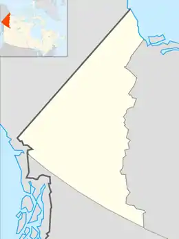 Mount Atherton Location in Yukon, Canada | |
| Highest point | |
| Elevation | 1,267 m (4,157 ft) |
| Parent peak | Mount Patterson (9.9 km away, at bearing 170 degrees). Mount Atherton is the highpoint of a ridge in the northern Pelly Mountains in south-central Yukon. |
| Coordinates | 62°01′44″N 133°53′39″W |
| Geography | |
| Location | Yukon, Canada |
| Parent range | Pelly Mountains |
| Topo map | NTS 105K/04 |
| Climbing | |
| Easiest route | The Robert Campbell Highway to the north offers access. |
Mount Atherton is part of the Saint Cyr Range, a remote mountain range in the Yukon, Canada.[6] It has an area of 6224 km2 and is a subrange of the Pelly Mountains which in turn form part of the Yukon Ranges.[7] Bivouac, the Canadian Mountain Encyclopedia refers to Mount Atherton being 1905m (6250 feet) with a prominence of 550m.[8]
The terrain around Mount Atherton [9] is mainly hilly, but to the southeast it is mountainous. The highest point nearby is 2,130 metres above sea level, 8.8 km east of Mount Atherton. The area around Mount Atherton is almost uninhabited, with less than two inhabitants per km2. There are no communities nearby. The closest town is Faro, Yukon.

The area around Mount Atherton is essentially an open bush landscape. The area is part of the Subarctic climate or boreal climate zone. The average annual temperature in the area is −7 °C (19 °F). The warmest month is July, when the average temperature is 8 °C (46 °F), and the coldest is December, with −18 °C (0 °F).[10]
Maps
- Administrative Boundaries Tay River 105K [11]
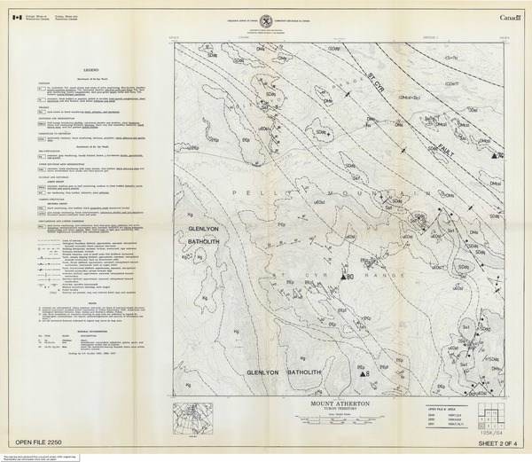
- Geoscience Map (General): Data Geology Reference Number:ARMC018806: Title Field map - Mount Atherton - 105K/4[12]
- Topographical map of Mount Atherton [13]
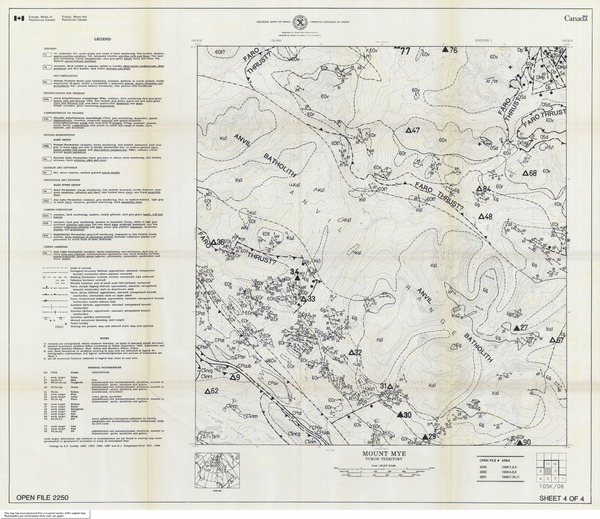
- Geological maps of Mount Atherton and surrounding area
- The Atlas of Canada - Toporama [17]
- Topography of Mount Atherton [18]
Canadian Government Sources
Further reading
References
- "Location of Mount Atherton".
- "Wikidata Entry 414366".
- "Mount Atherton Coordinates".
- Yukon Territory Legislative Assembly (2009). Linda Johnson (ed.). "With the People who Live Here: The History of the Yukon Legislature (1909-1961)".
- "Charles T Atherton" (PDF).
- "Geonames - Mount Atherton entry".
- Saint Cyr Range in the Canadian Mountain Encyclopedia
- "Canadian Mountain Encyclopedia: Mount Atherton".
- "Terrain around Mount Atherton".
- "NASA Earth Observations Data Set Index". 30 Jan 2016.
- "Administrative Boundaries of the region" (PDF).
- "Mount Atherton Geology".
- "Topographical map of Mount Atherton" (PDF).
- "Mount Atherton - 105K/4".
- "Rose Mountain, Yukon 105K/5]".
- "Mount Mye, Yukon 105K/6".
- "The Atlas of Canada".
- "Topography of Mount Atherton, Yukon, Canada".
- "Topography of Yukon".
- "Yukon Place Names: Mount Atherton" (PDF). p. 7.
- "Geoscan - Mount Atherton".
- "Government of Canada map of Mount Atherton".
- "Geoscan Home Page".
!["Rose Mountain, Yukon 105K/5]"](https://geoscan.nrcan.gc.ca/images/geoscan/gscof_2250_e_1990_mn02.jpg)