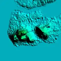
Mount Bongao
Mount Bongao (famously known as Bud Bongao) is a mountain located on Bongao Island in the province of Tawi-Tawi. It is a mountain formed with six limestone pillars that serves as its six peaks. It is the Philippines' southernmost peak.[2]
| Mount Bongao | |
|---|---|
  Relief map | |
| Highest point | |
| Elevation | 342 m (1,122 ft) [1] |
| Coordinates | 5°01′07″N 119°44′52″E [1] |
| Naming | |
| Native name | Bud Bongao |
| Geography | |
.svg.png.webp) Mount Bongao .svg.png.webp) Mount Bongao | |
| Country | Philippines |
| Region | Bangsamoro Autonomous Region in Muslim Mindanao |
| Province | Tawi-Tawi |
| City/municipality | Bongao |
| Climbing | |
| Easiest route | Barangay Pasiagan [1] |
Bud Bongao is inside the Bongao Peak Eco-Tourism Park that was inaugurated last July 3, 2017.[3] It is a 250-hectare forest that is one of the last remaining moist forests in the Sulu Archipelago.[4]
The mountain is of spiritual and traditional importance to the indigenous Sama Dilaut people.[5] The mountain is also considered sacred where it is believed that two Islamic preachers[6] who were direct followers of Karim ul-Makhdum, are buried under what is called Tampat Rocks,[4] although the site was already sacred even before Islam arrived. Karim ul-Makhdum brought Islam to the Philippines in the year 1380.[7]
Physical characteristics
Bud Bongao is composed of six limestone pillars that form six of its peaks, which serves as view points for the islands and locations they are named after.[6] These peaks are Bongao, Pajar, Sibutu (summit), Simunul, Tambisan, and Tinondakan.[1]
Biodiversity
Mount Bongao hosts one of the last remaining moist forests in the Sulu Archipelago.[4]
Monkeys endemic to Bud Bongao include Macaca fascicularis.[6] The red dragonfly, orange albatross, mangrove blue flycatcher, Philippine pitta are found on the mountain.[8] Bongao and its surrounding islands—Sanga-Sanga, Simunul, Tawi-Tawi—are also home to the vulnerable Tawi-Tawi forest rat and the Philippine slow loris.[9] The jungle flycatcher was once observed in 1973.[9]
Hiking activity
Aside from being a sacred mountain, Bud Bongao is also famous for hikers. A 3,608-step cobblestone trail[6] has been constructed from the jump-off at Barangay Pasiagan that ends at a view deck constructed on Tambisan Peak. The view deck offers a vantage point overlooking Celebes Sea and Tambisan Island in Sabah at 317 metres (1,040 ft) above sea level.[1]
References
- Malicdem, Ervin (7 June 2017). "Bud Bongao: Trail Data, Peaks and Elevation". 2017 Tawi-Tawi Mapping Expedition: 2–3. doi:10.13140/RG.2.2.10845.92647. Retrieved 16 October 2017.
- Lasco, Gideon. "Beyond Apo: Seven great hiking destinations in Mindanao". ABS-CBN News. Retrieved 2020-08-08.
- "ARMM spent P56 million to boost Bongao Peak tourism". Bureau of Public Information, ARMM Government. 5 July 2017. Archived from the original on 17 October 2017. Retrieved 16 October 2017.
- Yan, Gregg (28 April 2014). "Bud Bongao: The sacred mountain of Tawi-Tawi". Rappler. Retrieved 16 October 2017.
- WWF-Philippines 2012-2013 Annual Report (PDF).
- Malicdem, Ervin (7 June 2017). "Bud Bongao, Tawi-Tawi's Overwatch and Sacred Peak". Schadow1 Expeditions. Retrieved 16 October 2017.
- Jannaral, Julmunir (8 November 2016). "ARMM commemorates 636th Sheikh Karimul Makhdum Day". Manila Times. Retrieved 16 October 2017.
- Salvador, Jinggoy I. (2018-05-02). "Salvador: Breathtaking Bud Bongao". Sunstar. Retrieved 2020-08-08.
- "Sulu Archipelago rain forests". World Wildlife Fund. Retrieved 2020-08-08.
External links
![]() Media related to Mount Bongao at Wikimedia Commons
Media related to Mount Bongao at Wikimedia Commons