Mount Field (British Columbia)
Mount Field is a mountain located about 10 km (6 mi) east of the town of Field in Yoho National Park, Canada. The mountain was named in 1884[4] after Cyrus West Field, an American merchant who had laid the first Atlantic cable, 1858, a second in 1866; Mr. Field was visiting the Canadian Rockies the year as a guest of the CPR who were building the national railway, at the naming of a station and a mountain.[3]
| Mount Field | |
|---|---|
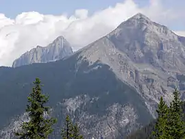 Mount Field with Mount Wapta in the background; near Field, British Columbia, Canada. | |
| Highest point | |
| Elevation | 2,643 m (8,671 ft) [1] |
| Prominence | 182 m (597 ft) [2] |
| Listing | Mountains of British Columbia |
| Coordinates | 51°25′51″N 116°27′46″W [3] |
| Geography | |
 Mount Field | |
| Parent range | President Range |
| Topo map | NTS 82N/08 |
| Climbing | |
| Easiest route | Scramble |
The Burgess Shale is located below the ridge connecting Mt. Field to Wapta Mountain.
References
- "Mount Field". PeakFinder.com. Retrieved 2019-08-20.
- "Mount Field". Bivouac.com. Retrieved 2016-07-02.
- "Mount Field". BC Geographical Names. Retrieved 2016-07-02.
- British Columbia official naming site
External links
- Mount Field in the Canadian Mountain Encyclopedia.
- Cyrus W. Field at the Atlantic Cable history website.
This article is issued from Wikipedia. The text is licensed under Creative Commons - Attribution - Sharealike. Additional terms may apply for the media files.