Mount Fumaiolo
Mount Fumaiolo (Italian Monte Fumaiolo) is a mountain of the northern Apennines range of Italy located in the southernmost corner of the Emilia-Romagna region, c. 70 km from the town of Cesena. It is at the border Emilia-Romagna and Tuscany.[1] With an elevation of 1,407 metres (4,616 ft), Mount Fumaiolo overlooks the villages of Balze di Verghereto, Bagno di Romagna and Verghereto, in Romagna, and thanks to its extensive fir and beech forests, it is a well-appreciated tourist area of natural interest. It is most famous for being the source of the Tiber, as well as the river Savio.[2][3]
| Mount Fumaiolo | |
|---|---|
 Mount Fumaiolo | |
| Highest point | |
| Elevation | 1,407 m (4,616 ft) |
| Prominence | 488 m (1,601 ft) |
| Coordinates | 43°47′15.20″N 12°4′33.95″E |
| Geography | |
| Location | Italy |
| Parent range | Apennine Mountains |
The Springs of the river Tiber
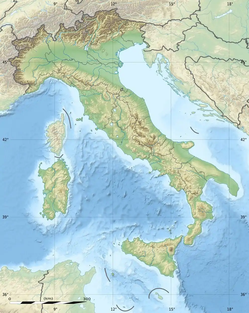
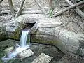
The source of the river Tiber (Tevere in Italian) consisted of two springs a few meters away from each other on the Mount Fumaiolo steeps. Although nowadays only one spring remains active, the area is still called "Le Vene del Tevere".[3] The spring is located in a beautiful beech forest at 1,268 meters above sea level on the Southern steeps of Mount Fumaiolo, near the village of Balze di Verghereto in the Emilia Romagna region. In 1927, under Benito Mussolini dictatorship an antique marble column from the Roman Forum was placed on the spot, with an inscription on it: QUI NASCE IL FIUME SACRO AI DESTINI DI ROMA ("Here springs the river / sacred to the destinies of Rome"), to mark the association of the Fascist regime with the ancient Roman empire. A Roman eagle stands on the top of the column, and three wolf heads holding a ring in their mouths are visible on the sides. In its first kilometers the river Tiber runs in Emilia Romagna, then it enters in Valtiberina, in Tuscany, before crossing the Umbria region and the Lazio region and Rome. After 405 kilometers, the river Tiber pours its waters into the Tirrenian sea. The Tiber is the third Italian river by length (after the rivers Po and Adige), and the second per water discharge, after the river Po.[1]
 The source of the Tiber
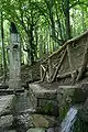 The source of the Tiber (side view)
 Benito Mussolini's inscription
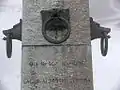 The inscription and ornaments
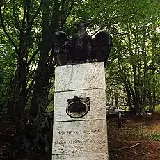 The eagle on the column
References
- "Mount Fumaiolo: source of the Tiber river - Le Ceregne Tuscany Farmhouse". Tuscanyfarmholiday.net. Retrieved 2013-09-28.
- "Fumaiolo". Turismo.fc.it. Archived from the original on 2012-02-18. Retrieved 2013-09-28.
- "Tiber Springs - Mount Fumaiolo". Turismo.fc.it. Retrieved 2013-09-28.