Mount Rose Summit
Mount Rose Summit is a mountain pass located in the Carson Range near Mount Rose and Slide Mountain northeast of Incline Village.[1][2] The 8,911 ft (2,716 m)-high pass is traversed by State Route 431, which is the highest point of the highway and the highest mountain pass open year-round in the Sierra Nevada.[1][3] The saddle itself features a parking lot and a small building which both serve as a highway stop. A closed dirt road leading to the Mount Rose Ski Resort ends near the northern section of the summit.[1]
| Mount Rose Summit | |
|---|---|
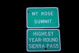 Sign on the summit | |
| Elevation | 8,911 ft (2,716 m) |
| Traversed by | |
| Location | Washoe County, Nevada, United States |
| Range | Carson Range / Sierra Nevada |
| Coordinates | 39°18′48″N 119°53′50″W |
| Topo map | USGS Mount Rose |
_in_Washoe_County%252C_Nevada%252C_with_Mount_Rose_visible_in_the_distance.jpg.webp)
View east along SR 431 crossing Mount Rose Summit, with Mount Rose visible to the left
References
- Google Earth images.
- "Mount Rose Summit, USGS Mount Rose (NV) Topo Map". USGS Quad maps. TopoQuest.com. Retrieved 2008-06-29.
- "Mount Rose Scenic Byway". U.S. Department of Transportation - National Scenic Byways Program. Retrieved 2008-04-02.
This article is issued from Wikipedia. The text is licensed under Creative Commons - Attribution - Sharealike. Additional terms may apply for the media files.