Mount Tsurumi
Mount Tsurumi (鶴見岳, Tsurumi-dake) is a 1,374.5 m (4,510 ft) volcano in Beppu, Ōita, Japan.
| Mount Tsurumi | |
|---|---|
| 鶴見岳 | |
 East side | |
| Highest point | |
| Elevation | 1,374.5 m (4,510 ft) |
| Listing | List of mountains and hills of Japan by height |
| Coordinates | 33°17′12″N 131°25′47″E |
| Naming | |
| Language of name | Japanese |
| Pronunciation | [tsɯɾɯmidake] |
| Geography | |
| Location | Beppu, Ōita, Japan |
| Topo map | Geographical Survey Institute 25000:1 別府東 |
| Geology | |
| Mountain type | Lava dome |
| Last eruption | March to May 867 CE |
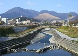
Tsurumi volcano (center)
Yufu volcano (left)
Yufu volcano (left)
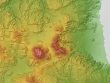
Outline
Mount Tsurumi is a lava dome. It has several peaks, including, Mount Kuranoto, Mount Uchi, Mount Garan. This mountain is one of Japan 300 mountains, and a part of Aso Kujū National Park.
Route
The easiest way to reach to the top of Mount Tsurumi is to use Kintetsu Beppu Ropeway. When walking up to the top, it takes about two hours from Toriimae Bus Stop and two and half hours from Higashi Tozanguchi Bus Stop.
Access
- Tsurumi Sanjo Station
- Toriimae Bus Stop
- Higashi Tozanguchi Bus Stop
Gallery
 ESE side
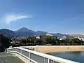
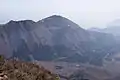 West side
External links
| Wikimedia Commons has media related to Mount Tsurumi. |
- Tsurumidake and Garandake: National catalogue of the active volcanoes in Japan - Japan Meteorological Agency
- Tsurumi Dake - Geological Survey of Japan
- Yufu-Tsurumi: Global Volcanism Program - Smithsonian Institution
| Authority control |
|---|
This article is issued from Wikipedia. The text is licensed under Creative Commons - Attribution - Sharealike. Additional terms may apply for the media files.