Mundaun
Mundaun is a former municipality in the district of Surselva in the canton of Graubünden, Switzerland. It was formed on 1 January 2009 through the merger of Flond and Surcuolm.[1] On 1 January 2016 the former municipalities of Obersaxen and Mundaun merged to form the new municipality of Obersaxen Mundaun.[2]
Mundaun | |
|---|---|
 | |
 Coat of arms | |
Location of Mundaun 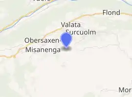
| |
 Mundaun Mundaun | |
| Coordinates: 46°45′N 9°8′E | |
| Country | Switzerland |
| Canton | Graubünden |
| District | Surselva |
| Area | |
| • Total | 8.59 km2 (3.32 sq mi) |
| Elevation | 1,346 m (4,416 ft) |
| Population (Dec 2014) | |
| • Total | 301 |
| • Density | 35/km2 (91/sq mi) |
| Time zone | UTC+01:00 (Central European Time) |
| • Summer (DST) | UTC+02:00 (Central European Summer Time) |
| Postal code(s) | 7137 |
| SFOS number | 3617 |
| Website | www SFSO statistics |
Geography

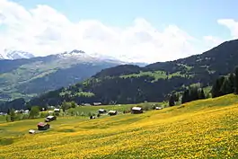
Mundaun had a combined area, as of 2006, of 8.6 km2 (3.3 sq mi). Of this area, 60.7% is used for agricultural purposes, while 29.0% is forested. Of the rest of the land, 4.7% is settled (buildings or roads) and the remainder (5.7%) is non-productive (rivers, glaciers or mountains).[3]
The former municipality is located in the Lugnez sub-district of the Surselva district. It is located on the Obersaxen high plateau south of the Vorderrhein river.
Demographics
Mundaun has a population (as of 2014) of 301, of which 6.2% of the population was made up of foreign nationals.[4]
The age distribution, as of 2000, in Mundaun is; 43 children or 13.9% of the population are between 0 and 9 years old and 44 teenagers or 14.2% are between 10 and 19. Of the adult population, 29 people or 9.4% of the population are between 20 and 29 years old. 49 people or 15.9% are between 30 and 39, 45 people or 14.6% are between 40 and 49, and 34 people or 11.0% are between 50 and 59. The senior population distribution is 24 people or 7.8% of the population are between 60 and 69 years old, 28 people or 9.1% are between 70 and 79, there are 13 people or 4.2% who are between 80 and 89.[4]
The historical population is given in the following table:[5][6][7]
| year | population |
|---|---|
| 1850 | 363 |
| 1900 | 248 |
| 1940 | 291 |
| 1950 | 245 |
| 1990 | 237 |
| 2000 | 309 |
References
- Amtliches Gemeindeverzeichnis der Schweiz published by the Swiss Federal Statistical Office (in German) accessed 23 September 2009
- Amtliches Gemeindeverzeichnis der Schweiz published by the Swiss Federal Statistical Office (in German) accessed 27 April 2016
- Swiss Federal Statistical Office accessed 09-Nov-2009. Values determined by combining statistics for the 2 former municipalities.
- Graubunden Population Statistics Archived 2009-08-27 at the Wayback Machine (in German) accessed 21 September 2009. Values determined by combining statistics for the 2 former municipalities.
- Mundaun in German, French and Italian in the online Historical Dictionary of Switzerland.
- Flond in German, French and Italian in the online Historical Dictionary of Switzerland.
- Graubunden in Numbers Archived 2009-09-24 at the Wayback Machine (in German) accessed 21 September 2009
| Wikimedia Commons has media related to Mundaun. |
External links
- Mundaun in German, French and Italian in the online Historical Dictionary of Switzerland.
- Surcuolm in German, French and Italian in the online Historical Dictionary of Switzerland.
- Flond in German, French and Italian in the online Historical Dictionary of Switzerland.