National Register of Historic Places listings in Blount County, Alabama
This is a list of the National Register of Historic Places listings in Blount County, Alabama.

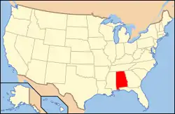
Location of Blount County in Alabama
This is intended to be a complete list of the properties and districts on the National Register of Historic Places in Blount County, Alabama, United States. Latitude and longitude coordinates are provided for many National Register properties and districts; these locations may be seen together in a Google map.[1]
There are 5 properties and districts listed on the National Register in the county.
- This National Park Service list is complete through NPS recent listings posted February 5, 2021.[2]
| [3] | Name on the Register | Image | Date listed[4] | Location | City or town | Description |
|---|---|---|---|---|---|---|
| 1 | Easley Covered Bridge | 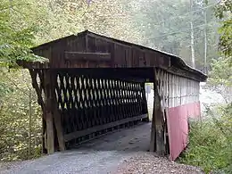 Easley Covered Bridge |
August 20, 1981 (#81000125) |
Spans Dub Branch 33°58′15″N 86°31′06″W |
Oneonta | |
| 2 | Robert G. Griffith Sr. House | 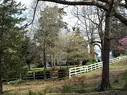 Robert G. Griffith Sr. House |
March 14, 2000 (#00000143) |
1204 County Road 25 34°12′38″N 86°28′38″W |
Summit | |
| 3 | Horton Mill Covered Bridge | 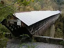 Horton Mill Covered Bridge |
December 29, 1970 (#70000099) |
5 miles (8 km) north of Oneonta on Route 3 34°00′58″N 86°26′55″W |
Oneonta | |
| 4 | Nectar Covered Bridge | 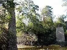 Nectar Covered Bridge |
August 20, 1981 (#81000124) |
8 miles southwest of Nectar 33°57′22″N 86°37′34″W |
Nectar | Bridge burned down on June 13, 1993.[5] |
| 5 | Swann Covered Bridge | 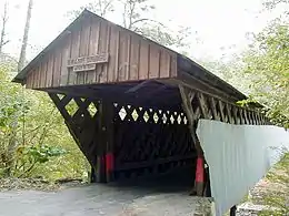 Swann Covered Bridge |
August 20, 1981 (#81000123) |
West of Cleveland 33°59′50″N 86°36′06″W |
Cleveland |
See also
| Wikimedia Commons has media related to National Register of Historic Places in Blount County, Alabama. |
References
- The latitude and longitude information provided in this table was derived originally from the National Register Information System, which has been found to be fairly accurate for about 99% of listings. Some locations in this table may have been corrected to current GPS standards.
- "National Register of Historic Places: Weekly List Actions". National Park Service, United States Department of the Interior. Retrieved on February 5, 2021.
- Numbers represent an alphabetical ordering by significant words. Various colorings, defined here, differentiate National Historic Landmarks and historic districts from other NRHP buildings, structures, sites or objects.
- The eight-digit number below each date is the number assigned to each location in the National Register Information System database, which can be viewed by clicking the number.
- "State reward offered in covered bridge fire in Blount County". Tuscaloosa News. July 2, 1993. Retrieved 5 May 2015.
Municipalities and communities of Blount County, Alabama, United States | ||
|---|---|---|
| Cities | Map of Alabama highlighting Blount County | |
| Towns | ||
| CDP | ||
| Unincorporated communities | ||
| Footnotes | ‡This populated place also has portions in an adjacent county or counties | |
| ||
This article is issued from Wikipedia. The text is licensed under Creative Commons - Attribution - Sharealike. Additional terms may apply for the media files.