Nautical publications
Nautical publications is a technical term used in maritime circles describing a set of publications, either published by national governments or by commercial and professional organisations, for use in safe navigation of ships, boats, and similar vessels. Other publications might cover topics such as seamanship and cargo operations. In the UK, the United Kingdom Hydrographic Office, the Witherby Publishing Group and the Nautical Institute provide numerous navigational publications, including charts, publications on how to navigate and passage planning publications. In the US, publications are issued by the US government and US Coast Guard.
The marine environment is subject to frequent change and the latest publications should always be used, especially when passage planning.
Hydrographic officers who produce of nautical publications also provide a system to inform mariners of changes that effect the chart. In the US and the UK, corrections and notifications of new editions are provided by various governmental agencies by way of Notice to Mariners, Local Notice to Mariners, Summary of Corrections, and Broadcast Notice to Mariners. Radio broadcasts give advance notice of urgent corrections.
A convenient way to keep track of corrections is with a Chart and Publication Correction Record system, either electronic or paper-based. Using this system, the navigator does not immediately update every publication in the library when a new Notice to Mariners arrives, instead creating a 'card' for every chart and noting the correction on this 'card'. When the time comes to use the publication, the navigator pulls the publication and its card, and makes the indicated corrections to the publication. This system ensures that every publication is properly corrected prior to use.
Various and diverse methods exist for the correction of electronic nautical publications.[3]
List of publications
List of Lights and Radio Signals
List of lights, including lighthouses and other prominent lights and also lists of radio stations used for navigation and communication are used in passage planning.
In the US, the United States Coast Guard Light List is an American navigation publication in seven volumes made available yearly by the U.S. Coast Guard which gives information on lighted navigation aids, unlighted buoys, radiobeacons, radio direction finder calibration stations, daybeacons and racons.
In the UK, the Admiralty List of Lights and the Admiralty List of Radio signals are split into separate volumes.[4][5]
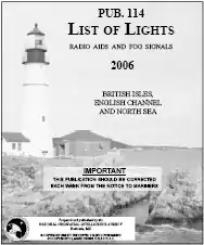
The List of Lights, Radio Aids, and Fog Signals is a navigation publication produced by the United States Defense Mapping Agency Hydrographic/Topographic Center. The book is usually referred to as the List of Lights, and should not be confused with the U.S. Coast Guard's Light List. The List of Lights is published in seven volumes, as Publication numbers 110 through 116. Each volume contains lights and other aids to navigation that are maintained by or under the authority of other governments.
The American Practical Navigator
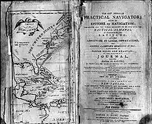
The American Practical Navigator, written by Nathaniel Bowditch, is an encyclopedia of navigation, valuable handbook on oceanography and meteorology, and contains useful tables and a maritime glossary. In 1866 the copyright and plates were bought by the Hydrographic Office of the United States Navy, and as a U.S. Government publication, it is now available for free online.[6] The US Coast Guard
Pilot Volumes/Sailing Directions
These provide a variety of information for the mariner, including details of harbours, ports, navigational hazards, local information and pilotage requirements.
In the UK, the Admiralty issues 76 volumes covering the world and these are used frequently by most merchant ships.[7]
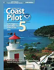
In the US, the United States Coast Pilots is a nine-volume American navigation publication distributed yearly by the National Ocean Service. Its purpose is to supplement nautical charts of US waters. Information comes from field inspections, survey vessels, and various harbour authorities. Maritime officials and pilotage associations provide additional information. Coast Pilots provides more detailed information than Sailing Directions because the latter is intended exclusively for the oceangoing mariner. Each volume of Coast Pilots must be regularly corrected using Notice to Mariners.
Sailing Directions is a 47-volume American navigation publication published by the Defense Mapping Agency Hydrographic/Topographic Center. It consists of 37 Enroute volumes and 10 Planning Guides. Planning Guides describe general features of ocean basins; Enroutes describe features of coastlines, ports, and harbors. Sailing Directions is updated when new data requires extensive revision of an existing text. These data are obtained from several sources, including pilots and Sailing Directions from other countries.
The World Port Index
The World Port Index contains a tabular listing of thousands of ports throughout the world, describing their location, characteristics, known facilities, and available services. Of particular interest are the applicable volume of Sailing Directions and the number of the harbor chart. The table is arranged geographically, with an alphabetical index. It issued by several different publishers.
Distances Between Ports
Distances Between Ports is a publication that lists the distances between major ports. Reciprocal distances between two ports may differ due to different routes chosen because of currents and climatic conditions. To reduce the number of listings needed, junction points along major routes are used to consolidate routes converging from different directions. It issued by several different publishers.
References
- "NAUTICAL PUBLICATIONS" (PDF).
- "Admiralty Digital List of Lights". The UK Hydrographic Office. Retrieved February 6, 2020.
- "Admiralty Digital List of Lights". The UK Hydrographic Office. Retrieved February 6, 2020.
- "The American Practical Navigator". Retrieved February 6, 2020.
- "Admiralty Sailing Directions". The UK Hydrographic Office. Retrieved February 6, 2020.