New Mexico State Road 132
State Road 132 (NM 132) is a state highway in the US state of New Mexico. Its total length is approximately 19.76 miles (31.80 km). NM 132's southern terminus is at NM 18/NM 218 in Hobbs, and the northern terminus is at Texas State Highway 83 (SH 83) and Farm to Market Road 769 (FM 769) at the Texas–New Mexico state line.
| ||||
|---|---|---|---|---|
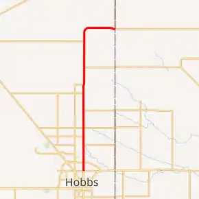
NM 132 highlighted in red | ||||
| Route information | ||||
| Maintained by NMDOT | ||||
| Length | 19.760 mi[1] (31.801 km) | |||
| Major junctions | ||||
| South end | ||||
| North end | ||||
| Location | ||||
| Counties | Lea | |||
| Highway system | ||||
| ||||

Major intersections
The entire route is in Lea County.
| Location | mi[2] | km | Destinations | Notes | |
|---|---|---|---|---|---|
| Hobbs | 0.000 | 0.000 | Southern terminus, western terminus of NM 218 | ||
| | 12.010 | 19.328 | Western terminus of NM 133 | ||
| | 15.030 | 24.188 | Eastern terminus of NM 83 | ||
| | 19.760 | 31.801 | Northern terminus at the Texas–New Mexico state line | ||
| 1.000 mi = 1.609 km; 1.000 km = 0.621 mi | |||||
See also
 U.S. roads portal
References
- "Posted Route: Legal Description" (PDF). New Mexico Department of Transportation. March 16, 2010. p. 91. Retrieved October 10, 2018.
- "TIMS Road Segments by Posted Route/Point with AADT Info; NM, NMX-Routes" (PDF). New Mexico Department of Transportation. April 3, 2013. pp. 5–7. Retrieved December 20, 2013.
External links
This article is issued from Wikipedia. The text is licensed under Creative Commons - Attribution - Sharealike. Additional terms may apply for the media files.