New Mexico State Road 378
State Road 378 (NM 378) is a 3.4-mile-long (5.5 km) state highway in far northern New Mexico. Beginning at a junction with NM 522, NM 378 heads generally west through the small town of Cerro and officially ends shortly thereafter at the boundary of BLM lands. The paved surface continues a few miles further under a different designation to end at the BLM's Wild Rivers National Recreation Area.
| ||||
|---|---|---|---|---|
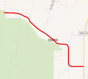
NM 378 highlighted in red | ||||
| Route information | ||||
| Maintained by NMDOT | ||||
| Length | 3.4 mi[1] (5.5 km) | |||
| Tourist routes | Part of Wild Rivers Back Country Byway | |||
| Major junctions | ||||
| West end | ||||
| East end | ||||
| Location | ||||
| Counties | Taos | |||
| Highway system | ||||
| ||||

Major intersections
The entire route is in Taos County.
| Location | mi[2] | km | Destinations | Notes | |
|---|---|---|---|---|---|
| | 0.000 | 0.000 | Western terminus | ||
| | 3.400 | 5.472 | Eastern terminus | ||
| 1.000 mi = 1.609 km; 1.000 km = 0.621 mi | |||||
See also
 U.S. Roads portal
References
- "NMDOT State Routes" (PDF). New Mexico Department of Transportation. Retrieved 2008-03-26.
- "TIMS Road Segments by Posted Route/Point with AADT Info; NM, X-Routes" (PDF). New Mexico Department of Transportation. April 3, 2013. pp. 5–7. Retrieved December 20, 2013.
This article is issued from Wikipedia. The text is licensed under Creative Commons - Attribution - Sharealike. Additional terms may apply for the media files.