Non Sung District
Non Sung (Thai: โนนสูง, pronounced [nōːn sǔːŋ]) is a district (amphoe) in the central part of Nakhon Ratchasima Province, northeastern Thailand.
Non Sung
โนนสูง | |
|---|---|
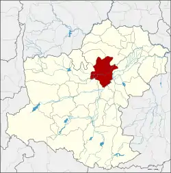 District location in Nakhon Ratchasima Province | |
| Coordinates: 15°10′48″N 102°15′25″E | |
| Country | Thailand |
| Province | Nakhon Ratchasima |
| Seat | Non Sung |
| Area | |
| • Total | 677.0 km2 (261.4 sq mi) |
| Population (2012) | |
| • Total | 127,178 |
| • Density | 187.9/km2 (487/sq mi) |
| Time zone | UTC+7 (ICT) |
| Postal code | 30160, 30420 |
| Geocode | 3010 |
Etymology
The old name of the district was Klang. The word klang in Thai means 'middle', which refers to the location of the district between the Nok District (now Bua Yai District) and Nai District (Mueang Nakhon Ratchasima District).
When Thai people had to choose a family name at the beginning of the 20th century, many of the locals created names with the word klang.
History
The district's name was changed from Non Wat to Non Sung in 1939.[1]
Geography
Neighbouring districts are (from the north clockwise) Khong, Phimai, Chakkarat, Chaloem Phra Kiat, Mueang Nakhon Ratchasima, Non Thai, and Kham Sakaesaeng.
Ban Non Wat, a village in the district, is an important Bronze Age archaeological site.
Administration
The district is divided into 16 sub-districts (tambons). There are seven townships (thesaban tambons) within the district: Non Sung covers tambon Non Sung; Talat Khae covers parts of tambon Than Prasat; Don Wai covers tambon Don Wai; Makha covers tambon Makha; Dan Khla covers tambon Dan Khla; Mai covers tambon Mai; and Ho Kham covers tambon Ho Kham.
| 1. | Non Sung | โนนสูง | |
| 2. | Mai | ใหม่ | |
| 3. | Tanot | โตนด | |
| 4. | Bing | บิง | |
| 5. | Don Chomphu | ดอนชมพู | |
| 6. | Than Prasat | ธารปราสาท | |
| 7. | Lum Khao | หลุมข้าว | |
| 8. | Makha | มะค่า | |
| 9. | Phon Songkhram | พลสงคราม | |
| 10. | Chan-at | จันอัด | |
| 11. | Kham Thao | ขามเฒ่า | |
| 12. | Dan Khla | ด่านคล้า | |
| 13. | Lam Kho Hong | ลำคอหงษ์ | |
| 14. | Mueang Prasat | เมืองปราสาท | |
| 15. | Don Wai | ดอนหวาย | |
| 16. | Lam Mun | ลำมูล |
References
- พระราชกฤษฎีกาเปลี่ยนนามอำเภอ กิ่งอำเภอ และตำบลบางแห่ง พุทธศักราช ๒๔๘๒ (PDF). Royal Gazette (in Thai). 56 (0 ก): 354–364. April 17, 1939.