Noyse Creek
Noyse Creek is a stream in the Capital Regional District of British Columbia, Canada. Located on southern Vancouver Island, it flows from its source to its mouth as a right tributary of Loss Creek.[3][1][4]
| Noyse Creek | |
|---|---|
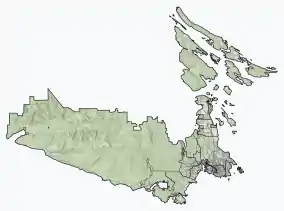 Location of the mouth of Noyse Creek  Noyse Creek (British Columbia) | |
| Location | |
| Country | Canada |
| Province | British Columbia |
| District | Capital Regional District |
| Physical characteristics | |
| Source | unnamed confluence |
| • location | San Juan Ridge |
| • coordinates | 48°32′44″N 124°11′50″W[1] |
| • elevation | 782 m (2,566 ft)[2] |
| Mouth | Loss Creek |
• coordinates | 48°29′47″N 124°14′10″W[3] |
• elevation | 150 m (490 ft) |
Course
Noyse Creek begins at an unnamed confluence on the south slope of the San Juan Ridge at an elevation of 782 metres (2,566 ft).[2] It flows southwest, and reaches its mouth as a right tributary of Loss Creek at an elevation of 150 metres (490 ft), south east of the settlement of Port Renfrew. Loss Creek flows to the Strait of Juan de Fuca on the Pacific Ocean.[3][1][4]
References
- "Toporama (on-line map and search)". Atlas of Canada. Natural Resources Canada. Retrieved 2020-10-23.
- "Google Earth". Retrieved 2020-10-23.
- "Noyse Creek". Geographical Names Data Base. Natural Resources Canada. Retrieved 2020-10-23.
- "Noyse Creek". BC Geographical Names. Retrieved 2020-10-23.
This article is issued from Wikipedia. The text is licensed under Creative Commons - Attribution - Sharealike. Additional terms may apply for the media files.