Ohio State Route 182
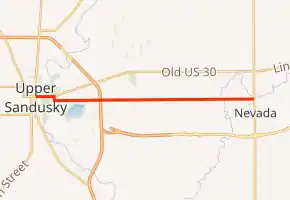
State Route 182 (SR 182) was a 7.97-mile-long (12.83 km) east–west state highway in the northwestern part of the U.S. state of Ohio. The route ran from Ohio State Route 231 in Nevada to SR 53, SR 67, and SR 199 in Upper Sandusky. It ran through the county of Wyandot.
| ||||
|---|---|---|---|---|
| ||||
| Route information | ||||
| Maintained by ODOT | ||||
| Length | 7.97 mi[1] (12.83 km) | |||
| Existed | 1923–2007 | |||
| Major junctions | ||||
| West end | ||||
| East end | ||||
| Location | ||||
| Counties | Wyandot | |||
| Highway system | ||||
| ||||

Route description
Along its path, SR 182 passes through the eastern portion of Wyandot County. No segments of SR 182 were included as a part of the National Highway System (NHS). The NHS is a network of highways that are identified as being most important for the economy, mobility and defense of the nation.[3]
History
The SR 182 designation was applied in 1923. It was originally routed from its western terminus in Upper Sandusky to Old SR 5 in Bucyrus.[4][5] Part of SR 182 was removed in 1971. They removed SR 231 in Nevada to U.S. 30 in Bucyrus.[6][7] In 2007, State Route 182 was no longer considered a state route.[8][9]
Major intersections
Junction list based on the route before it was deleted
The entire route is in Wyandot County.
| Location | mi[1] | km | Destinations | Notes | |
|---|---|---|---|---|---|
| Upper Sandusky | 0.00 | 0.00 | |||
| Nevada | 7.97 | 12.83 | |||
| 1.000 mi = 1.609 km; 1.000 km = 0.621 mi | |||||
References
- "State of Ohio - Department of Transportation - State Route Sections on Continuous Mileage Stationing (SR 182, Wyandot County)" (PDF). ODOT. January 2002. Archived from the original (PDF) on September 27, 2004. Retrieved September 1, 2014.
- Google (May 4, 2011). "Ohio State Route 182" (Map). Google Maps. Google. Retrieved May 4, 2011.
- National Highway System: Ohio (PDF) (Map). Federal Highway Administration. December 2003. Retrieved 2011-05-02.
- Map of Ohio State Highways (MrSID) (Map). Cartography by ODHPW. Ohio Department of Highways and Public Works. April 1922. Retrieved 2011-05-04.
- Map of Ohio Showing State Routes (MrSID) (Map). Cartography by ODHPW. Ohio Department of Highways and Public Works. July 1923. Retrieved 2011-05-04.
- Official Ohio Highway Map (MrSID) (Map). Cartography by ODOH. Ohio Department of Highways. 1936. Retrieved 2011-05-04.
- Official Ohio Highway Map (MrSID) (Map). Cartography by ODOH. Ohio Department of Highways. 1937. Retrieved 2011-05-04.
- Official Ohio Highway Map (MrSID) (Map). Cartography by ODOH. Ohio Department of Highways. 2003. Retrieved 2011-05-08.
- Official Ohio Highway Map (MrSID) (Map). Cartography by ODOH. Ohio Department of Highways. 2007. Retrieved 2011-05-08.