Onderbanken
Onderbanken (Dutch pronunciation: [ˈɔndərˌbɑŋkə(n)] (![]() listen); Limburgish: Óngerbenk) was a municipality in the southeastern Netherlands. In 2019, it merged with Nuth and Schinnen to form Beekdaelen.[3]
listen); Limburgish: Óngerbenk) was a municipality in the southeastern Netherlands. In 2019, it merged with Nuth and Schinnen to form Beekdaelen.[3]
Onderbanken
Óngerbenk | |
|---|---|
Former Municipality | |
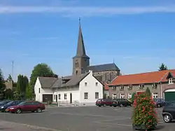 Church in Jabeek | |
 Flag  Coat of arms | |
.svg.png.webp) Location in Limburg | |
| Coordinates: 50°58′N 5°59′E | |
| Country | Netherlands |
| Province | Limburg |
| Municipality | Beekdaelen |
| Established | 1 January 1982 |
| Merged | 2019 |
| Area | |
| • Total | 21.24 km2 (8.20 sq mi) |
| • Land | 21.18 km2 (8.18 sq mi) |
| • Water | 0.06 km2 (0.02 sq mi) |
| Elevation | 68 m (223 ft) |
| Time zone | UTC+1 (CET) |
| • Summer (DST) | UTC+2 (CEST) |
| Postcode | 6447–6456 |
| Area code | 045, 046 |
| Website | www |
Population centres
Bingelrade, Douvergenhout, Etzenrade, Jabeek, Merkelbeek, Op den Hering, Quabeek, Raath, Schinveld, Viel.
Topography
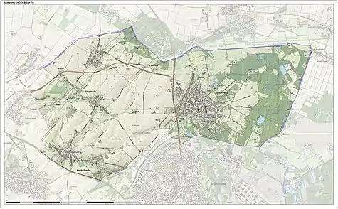
Dutch Topographic map of the municipality of Onderbanken, June 2015.
References
- "Kerncijfers wijken en buurten 2020" [Key figures for neighbourhoods 2020]. StatLine (in Dutch). CBS. 24 July 2020. Retrieved 19 September 2020.
- "Postcodetool for 6451EN". Actueel Hoogtebestand Nederland (in Dutch). Het Waterschapshuis. Retrieved 17 November 2013.
- "Gemeenteraad Beekdaelen beëdigd in gemeentehuis Nuth" [Town council of Beekdaelen sworn in at Nuth municipality office] (in Dutch). 1Limburg. Retrieved 2 March 2019.
External links
 Media related to Onderbanken at Wikimedia Commons
- Official website
This article is issued from Wikipedia. The text is licensed under Creative Commons - Attribution - Sharealike. Additional terms may apply for the media files.