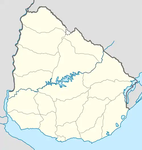
Palmar, Uruguay
Palmar is a village in the Soriano Department of western Uruguay.
Palmar | |
|---|---|
Village | |
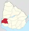
 Palmar Location in Uruguay | |
| Coordinates: 33°3′44″S 57°27′35″W | |
| Country | |
| Department | Soriano Department |
| Population (2011) | |
| • Total | 456 |
| Time zone | UTC -3 |
| Postal code | 75004 |
| Dial plan | +598 453 (+5 digits) |
Location
The village is located on Route 55 and the south bank of Río Negro, just south of the Palmar Dam. It lies about 75 kilometres (47 mi) east of Mercedes and at the border with Río Negro Department.
History
On 26 March 1982, the urban conglomeration named "Coronel Lorenzo Latorre", which had been formed in 1973 as a result of the construction of the Palmar Dam, was given the status of "Pueblo" (village) by the Act of Decreto-Ley Nº 15.254.[1] On 28 December 1990, it was renamed "Palmar" by the Act of Ley Nº 16.170.[2]
Population
In 2011 Palmar had a population of 381.[3]
| Year | Population |
|---|---|
| 1985 | 834 |
| 1996 | 703 |
| 2004 | 471 |
| 2011 | 381 |
Source: Instituto Nacional de Estadística de Uruguay[4]
References
- "Ley Nº 15.254". República Oriental del Uruguay, Poder Legislativo. 1982. Archived from the original on 4 March 2016. Retrieved 7 September 2012.
- "Ley Nº 16.170 (see article 705)". República Oriental del Uruguay, Poder Legislativo. 1990. Archived from the original on 1 February 2015. Retrieved 7 September 2012.
- "Censos 2011 Soriano (needs flash plugin)". INE. 2012. Retrieved 30 August 2012.
- "Statistics of urban localities (1963–2004)" (PDF). INE. 2012. Retrieved 7 September 2012.
This article is issued from Wikipedia. The text is licensed under Creative Commons - Attribution - Sharealike. Additional terms may apply for the media files.