Panagyurishte Nunatak
Panagyurishte Nunatak (Nunatak Panagyurishte \'nu-na-tak pa-na-'gyu-ri-shte\) is a rocky peak of elevation 150 m projecting from Yakoruda Glacier, Greenwich Island in the South Shetland Islands, Antarctica. The peak is named after the town of Panagyurishte in central Bulgaria.
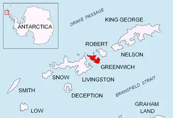
Location of Greenwich Island in the South Shetland Islands.
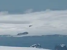
Panagyurishte Nunatak (on the opposite coast of McFarlane Strait, in the background) from Melnik Peak, Livingston Island.
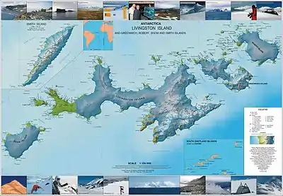
Topographic map of Livingston Island, Greenwich, Robert, Snow and Smith Islands.
Location
Panagyurishte Nunatak is located at 62°28′44″S 59°56′12″W, which is 2.8 km south of Crutch Peaks, 3.4 km west-southwest of Sevtopolis Peak, and 1.38 km northeast of Kerseblept Nunatak (Bulgarian topographic survey Tangra 2004/05 and mapping in 2009).
Maps
- L.L. Ivanov et al. Antarctica: Livingston Island and Greenwich Island, South Shetland Islands. Scale 1:100000 topographic map. Sofia: Antarctic Place-names Commission of Bulgaria, 2005.
- L.L. Ivanov. Antarctica: Livingston Island and Greenwich, Robert, Snow and Smith Islands. Scale 1:120000 topographic map. Troyan: Manfred Wörner Foundation, 2009. ISBN 978-954-92032-6-4
External links
- Panagyurishte Nunatak. SCAR Composite Antarctic Gazetteer
- Bulgarian Antarctic Gazetteer. Antarctic Place-names Commission. (details in Bulgarian, basic data in English)
External links
- Panagyurishte Nunatak. Copernix satellite image
This article includes information from the Antarctic Place-names Commission of Bulgaria which is used with permission.
This article is issued from Wikipedia. The text is licensed under Creative Commons - Attribution - Sharealike. Additional terms may apply for the media files.