Paria Peninsula
The Paria Peninsula, (Spanish: Península de Paria), is a large peninsula on the Caribbean Sea, in the state of Sucre in northern Venezuela.
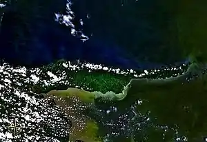
Satellite photo of the Paria Peninsula, between the Caribbean Sea (above/north) and Gulf of Paria (below/south).
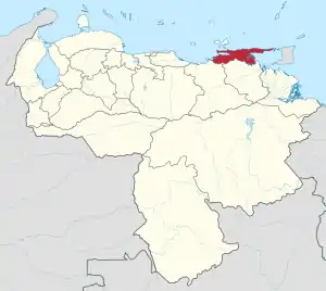
The Paria Peninsula is part of eastern Sucre State (red) in northeastern Venezuela.
Geography
It separates the Caribbean Sea from the Gulf of Paria.
The peninsula is part of the Serranía del Litoral mountain range, in the Venezuelan Coastal Range portion of the northern Andes. Its tip is within sight of the naked eye from the island of Trinidad.[1]
- National Park
Península de Paria National Park protects a section of the peninsula.
Paria Region
As a political subdivision, the Paria Region of the Paria Peninsula is the aggregation of six municipalities within Sucre State:
- Bermúdez Municipality — (capital: Carúpano),
- Arismendi Municipality — (capital: Río Caribe),
- Benítez Municipality — (capital: El Pilar),
- Libertador Municipality — (capital: Tunapuy),
- Mariño Municipality — (capital: Irapa)
- Valdez Municipality — (capital: Güiria).
See also
- Gulf of Paria topics
- Venezuelan Coastal Range topics
References
This article is issued from Wikipedia. The text is licensed under Creative Commons - Attribution - Sharealike. Additional terms may apply for the media files.