Parish of Bolderogery
Bolderogery, New South Wales is a civil parish of Gordon County, New South Wales.[1] a Cadastral divisions of New South Wales.[2]
| Bolderogery Parish New South Wales | |
|---|---|
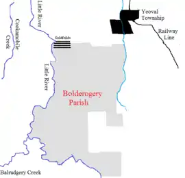 Bolderogery Parish Sketch Map | |
Bolderogery Parish Location in New South Wales | |
| Coordinates | 32°45′S 148°39′E |
| Postcode(s) | 2868 |
| LGA(s) | Cabonne Shire |
| County | Gordon |
| State electorate(s) | Orange |
| Federal Division(s) | Calare |
Bolderogery Parish is located between Yeoval, New South Wales and the Little River (Dubbo).
References
- Robert McLean, The New atlas of Australia : the complete work containing over one hundred maps and full descriptive geography of New South Wales, Victoria, Queensland, South Australia and Western Australia, together with numerous illustrations and copious indices (Sydney :J. Sands, [1886) Map 141.
- "Gordon County". Geographical Names Register (GNR) of NSW. Geographical Names Board of New South Wales.

This article is issued from Wikipedia. The text is licensed under Creative Commons - Attribution - Sharealike. Additional terms may apply for the media files.