Parish of Budda
Budda Parish in Cobar Shire is a civil parish of Rankin County,;[1] a Cadastral division of New South Wales.[2][3]
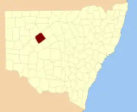
Rankin county NSW.
The Parish is on the Darling River upstream of Wilcannia, New South Wales and is located at 31°07′15″S 144°16′48″E.
Geography
The topography is flat with a Köppen climate classification of BsK (Hot semi arid).[4]
The economy in the parish is based on broad acre agriculture, based on Wheat and sheep.
History
The traditional owners of the area are the Barundji and Barkindji people.[5][6]
In 1835, explorer Major Thomas Mitchell was the first European to the region, in which he traced the Darling River to what is now Menindee.[7] In June 1866, the township of Wilcannia was proclaimed.[7]
See also
References
- [cartographer] C.A. Orwin, [https://nla.gov.au/nla.obj-233873384/view Map of the County of Rankin : Western Division, Land Districts of Bourke, Cobar and Wilcannia, N.S.W. 1912 (New South Wales. Department of Lands Title, Sydney N.S.W. 1914).
- "Rankin". Geographical Names Register (GNR) of NSW. Geographical Names Board of New South Wales. Retrieved 4 August 2013.

- The New atlas of Australia] (John Sands, 1886) map 22.
- Peel, M. C.; Finlayson, B. L.; McMahon, T. A. (2007). "Updated world map of the Köppen–Geiger climate classification". Hydrol. Earth Syst. Sci. 11: 1633–1644. doi:10.5194/hess-11-1633-2007. ISSN 1027-5606. (direct: Final Revised Paper)
- Norman Tindale's Catalogue of Australian Aboriginal Tribes
- Aboriginal Australia Map, David Horton (ed.), 1994 published in The Encyclopedia of Aboriginal Australia by AIATSIS.
- "Wilcannia – Culture and History". Fairfax Media. November 2008. Retrieved 25 March 2013.
This article is issued from Wikipedia. The text is licensed under Creative Commons - Attribution - Sharealike. Additional terms may apply for the media files.