Pascoe Vale Road, Melbourne
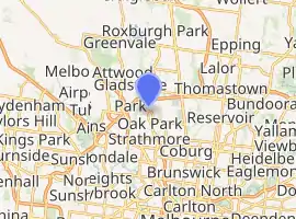
Pascoe Vale Road is a major thoroughfare through the northern suburbs of Melbourne continuing to the outer northern suburbs.[1] It runs in the South from its junction with Mount Alexander Road at Moonee Ponds Junction and continues North through the suburbs of Moonee Ponds, Essendon, Strathmore, forms the boundary between Pascoe Vale and Oak Park, continues through Oak Park, then on to Glenroy, forms the boundary between Jacana and Broadmeadows, continues through Broadmeadows, then forms the boundary between Meadow Heights and Coolaroo, before terminating at its intersection with Somerton Road, at the confluence of the suburbs of Meadow Heights, Coolaroo and Roxburgh Park. The road operates as an undivided road for much of its length, however, north of Broadmeadows, it becomes dual carriageway with an 80 km/hr speed limit.
Pascoe Vale Road | |
|---|---|
| |
| General information | |
| Type | Road |
| Length | 15 km (9.3 mi) |
| Route number(s) | |
| Major junctions | |
| North end | |
| |
| South end | |
| Location(s) | |
| Major suburbs | Meadow Heights, Coolaroo, Dallas, Broadmeadows, Jacana, Glenroy, Oak Park, Pascoe Vale, Strathmore |
The road houses both residential and commercial areas and in parts is serviced by tram number 59 and the Craigieburn railway line.
See also
![]() Australian Roads portal
Australian Roads portal
References
- VicRoads. "VicRoads – Register of Public Roads (Part A)". Government of Victoria. pp. 772–773. Archived from the original (PDF) on 29 December 2014. Retrieved 25 February 2015.