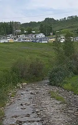
Pat's Creek (Alberta)
Pat's Creek is a tributary of the Peace River in northern Alberta, Canada whose mouth is located within the Town of Peace River.
| Pat's Creek | |
|---|---|
 Pat's Creek in Peace River | |
| Location | |
| Country | Canada |
| Province | Alberta |
| Physical characteristics | |
| Source | |
| • location | Northern Sunrise County |
| • coordinates | 56.216313°N 116.967244°W |
| • elevation | 745 m (2,444 ft) |
| Mouth | |
• location | Peace River |
• coordinates | 56.23339°N 117.297084°W |
• elevation | 320 m (1,050 ft) |
| Basin features | |
| River system | Peace River |
It is named after Patrick Wesley, a Métis man who lived in a cabin adjacent to the creek on his property. He deeded to the Anglican Church 5 acres of his land, including the creek, as tokens of his appreciation for care given to him during his final days in the battle with smallpox.[1]
Course
Pat's Creek originates in Northern Sunrise County, Alberta at an elevation of 745 meters (2,444 ft). It is formed by two legs from two separate sets of small connected unnamed lakes east of the community of St. Isidore. Flowing westwards, it receives waters from a small unnamed creek just east of St. Isidore and then passes the community just to the north of it less than 500 m away curving deep ravines on its course. Pat's Creek then receives another slightly larger creek just west of the community before being crossed by Highway 688 while flowing northwesterly. It continues westwards then southwesterly flowing between Kaufmann and Grouard hills. It is then channeled in 3 metre culvert for the remaining 1.5 kilometre under the roads, sidewalks, and parks[1] of the Town of Peace River, before emerging to join the Peace River at an elevation of 320 meters (1,050 ft).
Flooding
While the open creek through town posed as flooding is a concern especially during spring break-up, several days of torrential rains on July 2, 1935 caused the Pat's Creek burst its banks sending water gushing down Main Street Peace River along with and tree debris. The rains and flood waters from the tributaries caused the Peace River to rise more than 6.1 meters (20 ft) above its normal July levels.[1]
Highway slumpage
Highway 2 used to follow Pat's Creek into the Town of Peace River but had to be abandoned due to massive landslides on the section between Grouard Hill and Kauffman Hill. It is currently a 3 km (1.9 mi) wilderness interpretive trail above the creek.[2]
See also
References
- Norm Brownlee; edited by Beth Wilkins (Oct 21, 2010). "Pat's Creek saga runs through Peace River's history". Peace River Record Gazette.CS1 maint: extra text: authors list (link)
- Sources: Peace River Remembers, Archdiocese of Athabasca, I Remember, Record-Gazette, Northern Sunrise County Web site (Mar 15, 2005). "Peace River benefactor lends name to creek". Peace River Record Gazette.CS1 maint: multiple names: authors list (link)