Patriots' Path
The Patriots' Path is a multi-use trail in New Jersey, United States, with a total length of 90 miles (145 km).[1][2]
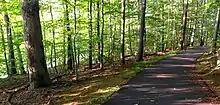
Patriots' Path off of Eden Lane, Hanover Township
| Patriots' Path | |
|---|---|
| Length | 90 mi (145 km) |
| Location | Morris County, New Jersey |
| Designation | National Recreation Trail |
| Trailheads | E. Hanover Township Washington Township |
| Use | Hiking, Mountain cycling |
| Hiking details | |
| Trail difficulty | Easy |
| Season | Year round |
| Surface | Asphalt, Crushed Stone, Gravel, Ballast, Grass, Dirt |
Patriots' Path stretches from East Hanover, which connects with the Lenape Trail in Essex County, to Allamuchy Mountain State Park in Sussex County, and the Village of High Bridge in Hunterdon County.[3] In southern Morris County, the path travels mostly along the corridors of the Whippany River, Black River, and Raritan River.[4] Different portions of Patriots' Path include bike trails (paved), cross-country skiing, equestrian trails, and hiking trails (handicap accessible).[5] Parts of the trail are along the right of way of the former Rockaway Valley Railroad.[6]
Points of interest along the trail include:
- Bamboo Brook Outdoor Education Center
- Frelinghuysen Arboretum
- Acorn Hall
- Ford Mansion
- Pocahontas Lake
- Speedwell Ironworks
- Lewis Morris County Park
- Jockey Hollow
- Black River Wildlife Management Area
- Nathan Cooper Gristmill
- Chubb Park
- Ken Lockwood Gorge WMA
- Schooley's Mountain County Park
- Elizabeth D. Kay Environmental Center
- Willowwood Arboretum[7]
- New Jersey Brigade Encampment Site[8]
- Washington Valley Historic District
Gallery
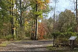 The trail passing the site of the Washington Valley Station of the Rockaway Valley Railroad.
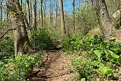 The trail by the Black River, near the Elizabeth D. Kay Environmental Center
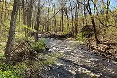 The Black River in the Black River County Park, with the trail on the left
See also
References
- “Patriots’ Path”, NYNJTC.org. Retrieved on July 5, 2014.
- "Biking in New Jersey County Facilities". NJDOT. May 17, 2005. Retrieved 10 January 2016.
- “Patriots’ Path” Archived 2013-09-01 at the Wayback Machine, Morris County, NJ Parks Commission. Retrieved on July 5, 2014.
- “Patriots’ Path”, NYNJTC.org. Retrieved on July 5, 2014.
- “Patriots’ Path” Archived 2013-09-01 at the Wayback Machine, Morris County, NJ Parks Commission. Retrieved on July 5, 2014.
- "Patriots' Path Mendham Borough" (PDF).
- “Patriots’ Path” Archived 2013-09-01 at the Wayback Machine, Morris County, NJ Parks Commission. Retrieved on July 5, 2014.
- "Jockey Hollow / New Jersey Brigade Area Trails Map" (PDF). National Park Service.
This article is issued from Wikipedia. The text is licensed under Creative Commons - Attribution - Sharealike. Additional terms may apply for the media files.