Pau dos Ferros
Pau dos Ferros is a municipality in the homonymous microregion, in Rio Grande do Norte state, Northeast Brazil.[4]
Pau dos Ferros | |
|---|---|
The Municipality of Pau dos Ferros | |
.jpg.webp) Clockwise: Independence Avenue; Church of Nossa Senhora da Conceição; Tourist Terminal Lindalva Torquato; panoramic view of the Pau dos Ferros; Joaquim Correia House of Popular Culture and Monsignor Caminha Square, with the Obelisk at found. | |
.png.webp) Flag .png.webp) Seal | |
| Nickname(s): Princesinha do Oeste (Princess of the West) and PDF | |
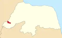 Location in the state of Rio Grande do Norte. | |
 Pau dos Ferros Location in Brazil | |
| Coordinates: 06°06′39″S 38°12′32″W | |
| Country | |
| Region | Nordeste |
| State | Rio Grande do Norte |
| Mesoregion | Oeste Potiguar |
| Microregion | Pau dos Ferros |
| Area | |
| • Total | 259.959 km2 (100.371 sq mi) |
| [1] | |
| Elevation | 193 m (633 ft) |
| Population (2020 [3]) | |
| • Total | 30,600 |
| • Density | 106.73/km2 (276.4/sq mi) |
| Demonym(s) | Pauferrense |
| Time zone | UTC -3 |
| Postal Code | 59900-000 |
| Area code(s) | (+55) 84 |
| Website | www.paudosferros.rn.gov.br |
History
The city was founded on September 4, 1856, initially as a village and then the town today is a city that has as its main form of economy the industrial sector and to a lesser extent agriculture.[5]
References
- "Área Territorial Brasileira - Consulta por Município" (in Portuguese). Brazilian Institute of Geography and Statistics. January 15, 2013. Archived from the original on June 3, 2015. Retrieved August 17, 2015.
- "Latitude e Longitude das cidades Brasileiras" (in Portuguese). Archived from the original on August 18, 2015. Retrieved February 3, 2017.
- IBGE 2020
- "Divisão Territorial do Brasil" (in Portuguese). Divisão Territorial do Brasil e Limites Territoriais, Instituto Brasileiro de Geografia e Estatística (IBGE). July 1, 2008. Retrieved December 17, 2009.
- Pau dos Ferros History in Portuguese
This article is issued from Wikipedia. The text is licensed under Creative Commons - Attribution - Sharealike. Additional terms may apply for the media files.