Pho Chai District
Pho Chai (Thai: โพธิ์ชัย, pronounced [pʰōː t͡ɕʰāj]) is a district (amphoe) in the northern part of Roi Et Province, Thailand.
Pho Chai
โพธิ์ชัย | |
|---|---|
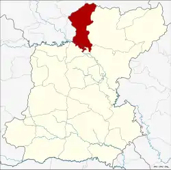 District location in Roi Et Province | |
| Coordinates: 16°19′25″N 103°46′9″E | |
| Country | Thailand |
| Province | Roi Et |
| Seat | Kham Pia |
| Area | |
| • Total | 394.3 km2 (152.2 sq mi) |
| Population (2005) | |
| • Total | 56,917 |
| • Density | 144.3/km2 (374/sq mi) |
| Time zone | UTC+7 (ICT) |
| Postal code | 45230 |
| Geocode | 4508 |
Geography
Neighboring districts are (from the east clockwise): Phon Thong, Selaphum, Chiang Khwan of Roi Et Province; Rong Kham, Don Chan, and Kuchinarai of Kalasin Province.
History
The minor district (king amphoe) was created on 1 April 1974, when the four tambons, Chiang Mai, Kham Pia, Sa-at, and Kham Pha-ung, were split off from Phon Thong District.[1] It was upgraded to a full district on 25 March 1979.[2]
Administration
The district is divided into nine sub-districts (tambons), which are further subdivided into 112 villages (mubans). There are two townships (thesaban tambons). Chai Wari covers parts of tambon Kham Pia, and Chiang Mai covers tambon Chiang Mai. There are a further eight tambon administrative organizations (TAO).
| No. | Name | Thai name | Villages | Pop. | |
|---|---|---|---|---|---|
| 1. | Kham Pia | ขามเปี้ย | 20 | 10,489 | |
| 2. | Chiang Mai | เชียงใหม่ | 12 | 8,140 | |
| 3. | Bua Kham | บัวคำ | 11 | 5,268 | |
| 4. | Akkha Kham | อัคคะคำ | 14 | 7,817 | |
| 5. | Sa-at | สะอาด | 14 | 4,675 | |
| 6. | Kham Pha-ung | คำพอุง | 13 | 8,950 | |
| 7. | Nong Ta Kai | หนองตาไก้ | 10 | 3,592 | |
| 8. | Don Ong | ดอนโอง | 10 | 4,237 | |
| 9. | Pho Si | โพธิ์ศรี | 8 | 3,749 |
References
- ประกาศกระทรวงมหาดไทย เรื่อง แบ่งท้องที่อำเภอโพนทอง จังหวัดร้อยเอ็ด ตั้งเป็นกิ่งอำเภอโพธิ์ชัย (PDF). Royal Gazette (in Thai). 91 (58 ง): 801. April 2, 1974.
- พระราชกฤษฎีกาตั้งอำเภอหนองกุงศรี อำเภอไทรงาม อำเภอบ้านฝาง อำเภออุบลรัตน์ อำเภอเวียงชัย อำเภอดอยเต่า อำเภอนิคมคำสร้อย อำเภอนาหว้า อำเภอเสิงสาง อำเภอศรีสาคร อำเภอบึงสามพัน อำเภอนาดูน อำเภอค้อวัง อำเภอโพธิ์ชัย อำเภอเมืองสรวง อำเภอปลวกแดง อำเภอยางชุมน้อย อำเภอกาบเชิง อำเภอสุวรรณคูหา และอำเภอกุดข้าวปุ้น พ.ศ. ๒๕๒๒ (PDF). Royal Gazette (in Thai). 96 (42 ก Special): 19–24. March 25, 1979.