Picacho del Diablo
Picacho del Diablo ('Devil's Peak') is the highest peak on the Baja California peninsula, measuring 3,096 metres (10,157 ft). It is alternately called Cerro de la Encantada, meaning 'Hill of the Enchanted'[2] or 'Hill of the Bewitched'. The peak is located in the Sierra de San Pedro Mártir, a part of the Peninsular Ranges in the Mexican state of Baja California.
| Picacho del Diablo | |
|---|---|
| Cerro de la Encantada | |
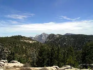 Picacho del Diablo as seen from the National Astronomical Observatory of Mexico | |
| Highest point | |
| Elevation | 3,096 m (10,157 ft) |
| Prominence | 2,115 m (6,939 ft) [1] |
| Listing |
|
| Coordinates | 30°59′27″N 115°22′30″W [3] |
| Naming | |
| English translation | Devil's Peak |
| Language of name | Spanish |
| Geography | |
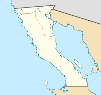 Picacho del Diablo Location in Mexico 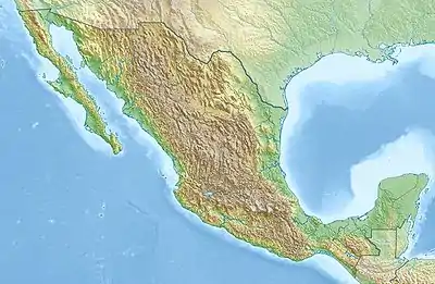 Picacho del Diablo Picacho del Diablo (Mexico) | |
| Location | Sierra de San Pedro Mártir National Park, Mexicali Municipality, Baja California, Mexico |
| Parent range | Sierra San Pedro Mártir |
| Topo map | H11B45 San Rafael |
| Climbing | |
| Easiest route | class 3 scramble |
Climate
The peak has a cold-summer Mediterranean climate (Csc) in the Köppen climate classification.[4]
| Climate data for Picacho del Diablo Peak (1981–2010) | |||||||||||||
|---|---|---|---|---|---|---|---|---|---|---|---|---|---|
| Month | Jan | Feb | Mar | Apr | May | Jun | Jul | Aug | Sep | Oct | Nov | Dec | Year |
| Average high °C (°F) | 6.9 (44.4) |
5.3 (41.5) |
5.4 (41.7) |
7.8 (46.0) |
11.2 (52.2) |
16.1 (61.0) |
19.1 (66.4) |
18.9 (66.0) |
16.9 (62.4) |
12.8 (55.0) |
9.1 (48.4) |
7.2 (45.0) |
11.4 (52.5) |
| Daily mean °C (°F) | 2.6 (36.7) |
1.3 (34.3) |
0.9 (33.6) |
2.7 (36.9) |
5.6 (42.1) |
9.8 (49.6) |
13.0 (55.4) |
13.0 (55.4) |
11.2 (52.2) |
7.8 (46.0) |
4.4 (39.9) |
2.9 (37.2) |
6.3 (43.3) |
| Average low °C (°F) | −1.7 (28.9) |
−2.8 (27.0) |
−3.6 (25.5) |
−2.4 (27.7) |
0.1 (32.2) |
3.5 (38.3) |
7.0 (44.6) |
7.2 (45.0) |
5.5 (41.9) |
2.8 (37.0) |
−0.2 (31.6) |
−1.5 (29.3) |
1.2 (34.1) |
| Average precipitation mm (inches) | 151 (5.9) |
140 (5.5) |
176 (6.9) |
12 (0.5) |
7 (0.3) |
2 (0.1) |
44 (1.7) |
52 (2.0) |
36 (1.4) |
13 (0.5) |
50 (2.0) |
111 (4.4) |
794 (31.2) |
| Source: climatewna.com[4] | |||||||||||||
See also
- List of mountains in Mexico
- Mountain peaks of North America
- List of Ultras of Mexico
References
- "Picacho del Diablo". Peakbagger.com. Archived from the original on 2020-09-08. Retrieved 8 September 2020.
- "Desert Peaks Section Peaks List" (PDF). Sierra Club Angeles Chapter. May 2020. Archived (PDF) from the original on 2020-09-08. Retrieved 8 September 2020.
- Martin, Andy (26 March 2011). "Mexico Ultras". Peaklist.org. Archived from the original on 2012-11-14. Retrieved 22 October 2012.
- "ClimateNA_Map". www.climatewna.com. University of British Columbia. 2019. Retrieved 2019-05-18.
This article is issued from Wikipedia. The text is licensed under Creative Commons - Attribution - Sharealike. Additional terms may apply for the media files.