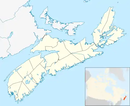
Pockwock, Nova Scotia
Pockwock is one of four Black Nova Scotian settlements in Upper Hammonds Plains.[1] People in this area are mostly descendants of War of 1812 refugees.[1] It is located in the Halifax Regional Municipality in the Canadian province of Nova Scotia. The Halifax Regional Water Commission uses Pockwock Lake as a source for water for the communities of Halifax, Bedford and Lower Sackville.

Pockwock in Nova Scotia
Climate
| Climate data for Pockwock (1981–2010) | |||||||||||||
|---|---|---|---|---|---|---|---|---|---|---|---|---|---|
| Month | Jan | Feb | Mar | Apr | May | Jun | Jul | Aug | Sep | Oct | Nov | Dec | Year |
| Record high °C (°F) | 14.5 (58.1) |
17.5 (63.5) |
23.0 (73.4) |
24.5 (76.1) |
32.5 (90.5) |
34.0 (93.2) |
33.0 (91.4) |
35.0 (95.0) |
34.0 (93.2) |
25.5 (77.9) |
19.0 (66.2) |
16.0 (60.8) |
35.0 (95.0) |
| Average high °C (°F) | −1.8 (28.8) |
−0.7 (30.7) |
2.9 (37.2) |
8.5 (47.3) |
15.0 (59.0) |
20.2 (68.4) |
23.6 (74.5) |
23.3 (73.9) |
19.0 (66.2) |
13.0 (55.4) |
7.0 (44.6) |
1.5 (34.7) |
11.0 (51.8) |
| Daily mean °C (°F) | −6.2 (20.8) |
−5.1 (22.8) |
−1.3 (29.7) |
4.1 (39.4) |
9.9 (49.8) |
14.9 (58.8) |
18.5 (65.3) |
18.5 (65.3) |
14.5 (58.1) |
8.8 (47.8) |
3.3 (37.9) |
−2.4 (27.7) |
6.5 (43.7) |
| Average low °C (°F) | −10.6 (12.9) |
−9.5 (14.9) |
−5.6 (21.9) |
−0.3 (31.5) |
4.7 (40.5) |
9.6 (49.3) |
13.3 (55.9) |
13.7 (56.7) |
10.0 (50.0) |
4.6 (40.3) |
−0.4 (31.3) |
−6.3 (20.7) |
1.9 (35.4) |
| Record low °C (°F) | −29.0 (−20.2) |
−36.0 (−32.8) |
−22.5 (−8.5) |
−13.0 (8.6) |
−4.0 (24.8) |
0.5 (32.9) |
6.0 (42.8) |
4.0 (39.2) |
−2.0 (28.4) |
−5.0 (23.0) |
−12.5 (9.5) |
−24.5 (−12.1) |
−36.0 (−32.8) |
| Average precipitation mm (inches) | 149.0 (5.87) |
126.8 (4.99) |
138.9 (5.47) |
119.9 (4.72) |
129.3 (5.09) |
100.9 (3.97) |
99.5 (3.92) |
87.3 (3.44) |
118.0 (4.65) |
139.2 (5.48) |
158.7 (6.25) |
145.7 (5.74) |
1,513.2 (59.57) |
| Average rainfall mm (inches) | 94.2 (3.71) |
79.2 (3.12) |
101.1 (3.98) |
109.2 (4.30) |
128.6 (5.06) |
100.9 (3.97) |
99.5 (3.92) |
87.3 (3.44) |
118.0 (4.65) |
139.2 (5.48) |
142.0 (5.59) |
105.6 (4.16) |
1,304.7 (51.37) |
| Average snowfall cm (inches) | 54.4 (21.4) |
46.8 (18.4) |
36.1 (14.2) |
10.5 (4.1) |
0.7 (0.3) |
0.0 (0.0) |
0.0 (0.0) |
0.0 (0.0) |
0.0 (0.0) |
0.0 (0.0) |
16.5 (6.5) |
39.6 (15.6) |
204.7 (80.6) |
| Average precipitation days (≥ 0.2 mm) | 15.0 | 11.9 | 13.9 | 15.7 | 16.5 | 14.2 | 13.7 | 13.5 | 13.6 | 16.1 | 16.7 | 16.2 | 177.0 |
| Average rainy days (≥ 0.2 mm) | 7.3 | 6.3 | 9.7 | 14.4 | 16.5 | 14.2 | 13.7 | 13.5 | 13.6 | 16.1 | 15.4 | 10.4 | 151.6 |
| Average snowy days (≥ 0.2 cm) | 8.8 | 6.7 | 5.5 | 2.2 | 0.20 | 0.0 | 0.0 | 0.0 | 0.0 | 0.04 | 1.9 | 7.0 | 32.3 |
| Source: Environment Canada[2] | |||||||||||||
References
- LTD, African Nova Scotian Directory. "Hammonds Plains, Canada, Nova Scotia, Hammonds Plains | African Nova Scotian Directory". ansd.ca.
- "Pockwock Lake, Nova Scotia". Canadian Climate Normals 1981–2010. Environment Canada. Retrieved 12 May 2015.
This article is issued from Wikipedia. The text is licensed under Creative Commons - Attribution - Sharealike. Additional terms may apply for the media files.