Port Island, Seychelles
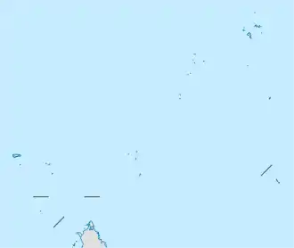
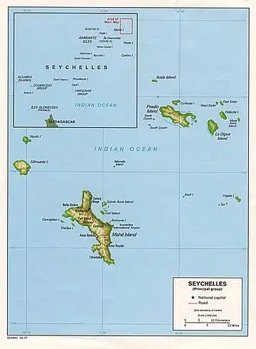
Port Island (French: Ile du Port) is an artificial island in Seychelles, lying 2 km from the capital Victoria.
| Ile du Port | |
|---|---|
 Port Island | |
| Geography | |
| Location | Seychelles, Indian Ocean |
| Coordinates | 4.614°S 55.461°E |
| Archipelago | Inner Islands, Seychelles |
| Adjacent bodies of water | Indian Ocean |
| Area | 0.587 km2 (0.227 sq mi) |
| Length | 1.2 km (0.75 mi) |
| Width | 0.7 km (0.43 mi) |
| Coastline | 3.5 km (2.17 mi) |
| Highest elevation | 0 m (0 ft) |
| Administration | |
| Group | Granitic Seychelles |
| Sub-Group | Mahe Islands |
| Sub-Group | Mahe Port Islands |
| Districts | English River |
| Largest settlement | North Point (pop. 10) |
| Demographics | |
| Population | 10 (2014) |
| Pop. density | 17/km2 (44/sq mi) |
| Ethnic groups | Creole, French, East Africans, Indians. |
| Additional information | |
| Time zone |
|
| ISO code | SC-16 |
| Official website | www |
History
The island was constructed between 1995 and 2002. It belongs to the Mahe Port Islands, which are mostly artificial islands created by funds from Dubai when the Dubai dredger was placed in Seychelles. The works began in 1998 [1][2] in 2009 the new Seychelles National Assembly building was inaugurated.[3] In 2012 the island was ready for installment of wind turbines.[4][5] In 2013 the island was visited by UN inspectors inspecting worldwide scale of wind farms.[6] In the end of 2013 the wind farm was launched[7] in 2014, it was reported that the PUC farm on Port Island was a success[8][9][10]
Geography
The artificial island plan is a Mixed Commercial, Governmental, Financial, Port & Fisheries [11]
Facilities
The Port Island causeway connects Port Island to Perseverance Island and to mainland Mahe.
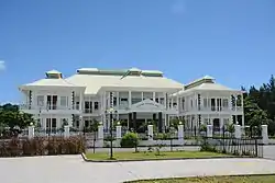
- Seychelles National Assembly
- Judiciary
- Stock Exchange Building
- University of Port Island
- Park
- Petrol Station
- SPTC Headquarters
- SIBA Headquarters
- Fish canning Factory
- Storage Facilities
- New Port section
- PUC farm
- Hotel - new govt. Hotel
- Heliport
- IKEA store
Demographics
The construction camp is located near the Seychelles National Assembly building on the north point.
Administration
The island belongs to English River District.[12]
Image gallery
 Map 1
Map 1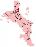 District Map
References
- "phase 2 completed for all islands in news". Archived from the original on 2016-04-17. Retrieved 2016-04-03.
- phase 2 completed for all islands in news
- "Opening of the New National Assembly Building". YouTube (in French). SBC Seychelles. 4 December 2009.
- News
- News
- News
- Masdar Launch in news
- Report on Port Island
- Quick facts from Masdar
- Info from Masdar
- "Island development info" (PDF). Archived from the original (PDF) on 2016-04-15. Retrieved 2016-04-03.
- District map