Port of Kokkola
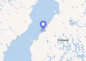
The Port of Kokkola is a cargo port located in the city of Kokkola, on the west coast of Finland and the eastern shore of the Bothnian Bay.
| Port of Kokkola | |
|---|---|
 Port of Kokkola deepwater harbour | |
| |
Native name | Kokkolan satama – Karleby hamn |
| Location | |
| Country | Finland |
| Location | Kokkola |
| Coordinates | 63.855556°N 23.013889°E |
| UN/LOCODE | FI KOK[1] |
| Details | |
| Operated by | Kokkolan Satama Oy |
| Type of harbor | coastal natural |
| Draft depth | max. 14.0 metres (45.9 ft) depth |
| Statistics | |
| Annual cargo tonnage | c. 6.7m tons (int'l) (2018)[2] |
| Website https://portofkokkola.fi/en/port-of-kokkola/ | |
In 2018, the port handled c. 6.7 million tons of international cargo.[2] Of this, c. 77% was exports, making Kokkola the fourth-largest export port in Finland, by tonnage.[2]
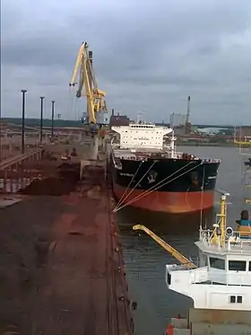
The port complex consists of three areas:[3]
- Kantasatama 'core' harbour: containerised and general cargo as well as 'clean' bulk; facilities include a covered 'all-weather-terminal'; 5 quays, total length 692 metres (2,270 ft); depth of fairways 4.0–9.5 metres (13.1–31.2 ft)
- Hopeakivi harbour: mainly dealing with light bulk cargo; 2 quays, total length 317 metres (1,040 ft); depth 9.5 metres (31 ft)
- Deepwater harbour: mainly dealing with bulk cargo, accounting for c. 70% of the port's total throughput; 6 quays, total length 1,266 metres (4,154 ft); depth 9.5–14.0 metres (31.2–45.9 ft)
There are also a total of 15 cranes and 79,000 square metres (850,000 sq ft) of warehousing within the complex.[3]
References
- "UN/LOCODE - Finland". United Nations. Retrieved 2 October 2020.
- "Traficom International Maritime Statistics 2019" (PDF). Traficom.fi (in Finnish). Finnish Transport and Communications Agency. Retrieved 1 October 2020.
- "The port of three ports - Port of Kokkola". PortOfKokkola.fi. Retrieved 1 October 2020.
External links
This article is issued from Wikipedia. The text is licensed under Creative Commons - Attribution - Sharealike. Additional terms may apply for the media files.