Potaissa (castra)
Potaissa was a castra in the Roman province of Dacia, located in today's Turda, Romania.
| Potaissa | |
|---|---|
 | |
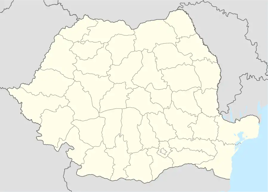 Location within Romania | |
| Alternative name(s) | Patavissa,[1] Patabissa,[2] Patauissa, Patruissa,[1] Patrouissa, Patreuissa |
| Known also as | Castra of Turda |
| Founded during the reign of | Marcus Aurelius |
| Founded | 168 |
| Abandoned | c. 4th-5th century [3] |
| Attested by | Tabula Peutingeriana |
| Place in the Roman world | |
| Province | Dacia |
| Administrative unit | Dacia Apulensis |
| Administrative unit | Dacia Superior |
| Directly connected to |
|
| Structure | |
| — Stone structure — | |
| Size and area | 573 m × 408 1 m (23,37 ha) |
| — Wood and earth structure — | |
| Stationed military units | |
| — Legions — | |
| V Macedonica [4] | |
| Location | |
| Coordinates | 46.5705°N 23.7724°E |
| Altitude | c. 369 m |
| Place name | Fortress' Hill |
| Town | Turda |
| County | Cluj |
| Country | |
| Reference | |
| RO-LMI | CJ-I-s-A-07208 |
| RO-RAN | 52268.01 |
| Site notes | |
| Recognition | |
| Condition | Ruined |
| Excavation dates | 1950 |
History
The Dacians established a town that Ptolemy in his Geography calls Patreuissa, which is probably a corruption of Patavissa or Potaissa, the latter being more common. It was conquered by the Romans, who kept the name Potaissa, between AD 101 and 106, during the rule of Trajan, together with parts of Decebal's Dacia.[5]
The name Potaissa is first recorded on a Roman milliarium discovered in 1758 in the nearby Aiton commune.[6]
Milliarium of Aiton is an ancient Roman milestone dating from 108 AD, shortly after the Roman conquest of Dacia, and showing the construction of the road from Potaissa to Napoca, by demand of the Emperor Trajan. It indicates the distance of 10,000 feet (3,000 m) (P.M.X.) to Potaissa. This is the first epigraphical attestation of the settlements of Potaissa and Napoca in Roman Dacia.
The complete inscription is: "Imp(erator)/ Caesar Nerva/ Traianus Aug(ustus)/ Germ(anicus) Dacicus/ pontif(ex) maxim(us)/ (sic) pot(estate) XII co(n)s(ul) V/ imp(erator) VI p(ater) p(atriae) fecit/ per coh(ortem) I Fl(aviam) Vlp(iam)/ Hisp(anam) mil(liariam) c(ivium) R(omanorum) eq(uitatam)/ a Potaissa Napo/cam / m(ilia) p(assuum) X". It was recorded in the Corpus Inscriptionum Latinarum, vol. III, the 1627, Berlin, 1863.
This milliarium is an attestation of the road known to be built by Cohors I Hispanorum miliaria.[7]
The castrum established was named Potaissa too and became a municipium, then a colonia. Potaissa was the basecamp of the Legio V Macedonica from 166 to 274.
The Potaissa salt mines were worked in the area since prehistoric times.
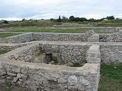
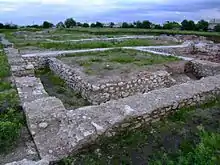
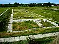
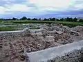 Thermae
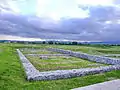
See also
Notes
- Schütte, Gudmund (1917). "Ptolemy's maps of northern Europe, a reconstruction of the prototypes". The Royal Danish Geographical Society. Retrieved 2013-05-04.
- Dana, Dan; Nemeti, Sorin (2014-01-09). "Ptolémée et la toponymie de la Dacie (II-V)". Classica et Christiana. p. 18. Retrieved 2014-03-30.
- Raport de cercetare arheologică 1983-1992, de prof.dr. Mihai Bărbulescu și co.
- Constantin C. Petolescu: Dacia - Un mileniu de istorie, Ed. Academiei Române, 2010, ISBN 978-973-27-1999-2
- (in Romanian) "Epoca dacică" at the Turda City Hall site; accessed March 21, 2013
- Lazarovici et al. 1997, pp. 202–3 (6.2 Cluj in the Old and Ancient Epochs)
- ARCHAEOLOGICAL REPERTORY OF ROMANIA. Archive Of The Vasile Parvan Institute Of Archaeology – Site Location Index
External links
 Media related to Potaissa castrum at Wikimedia Commons
- Roman castra from Romania - Google Maps / Earth