Powell Plateau (Arizona)
Powell Plateau, named for geologist and explorer John Wesley Powell, is a 7,661-foot-elevation plateau-summit located in western Grand Canyon, about 13 mi northwest of Grand Canyon Village in Coconino County of northern Arizona, USA. Being a large plateau. (~300 acres, 0.47 mi2), the plateau causes a large west-northeast-north excursion of the west-flowing Colorado River, caused by the southwest arm of the plateau. There is a slightly-southeast trending arm, and the main plateau then trends north to higher elevations.
| Powell Plateau (Arizona) | |
|---|---|
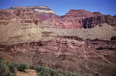
.jpg.webp) (an area adjacent Powell Plateau) (Steamboat Mountain in the distance) | |
| Highest point | |
| Elevation | 7,661 ft (2,335 m) |
| Prominence | 961 ft (293 m) [1] |
| Parent peak | Kaibab Plateau (Swamp Point) |
| Isolation | 3.0 mi (4.8 km) |
| Coordinates | 36.3368°N 112.3726°W |
| Geography | |
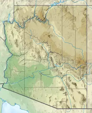
 Powell.Plateau Location in Arizona  Powell.Plateau Powell.Plateau (the United States) | |
| Location | (West)-Grand Canyon National Park Coconino County, Arizona, US |
| Parent range | Kaibab Plateau Colorado Plateau |
| Topo map | USGS King Arthur Castle |
| Geology | |
| Age of rock | Permian |
| Mountain type | sedimentary rock: limestone, siltstone, mudstone, sandstone, shale |
| Type of rock | Kaibab Limestone, Toroweap Formation, Coconino Sandstone, Hermit Shale, Supai Group, Redwall Limestone, Muav Limestone, Bright Angel Shale |
The east side of Powell Plateau is drained by White Creek (Muav Canyon), and is traversed by the North Bass Trail. The high point prominence is at the plateau's north terminus, opposite Swamp Point, (North Rim). The high point at the southeast arm's terminus adjacent Dutton Point is 7,538 ft. The high point of the southwest arm is 6,883 ft.

External links
Reflist
| Wikimedia Commons has media related to Powell Plateau. |
- "Powell Plateau - 7,661' AZ". Lists of John. Retrieved January 14, 2021.