R569 road (Ireland)
The R569 road is a regional road in County Kerry, Ireland. It travels from the N71 road at Kenmare to the N22, via the village of Kilgarvan.[2] The road follows the course of the Roughty River for the greater part of its route. The R569 is 25.0 kilometres (15.5 mi) long.[1][2]
| ||||
|---|---|---|---|---|
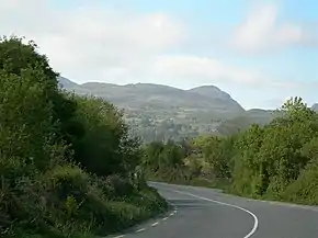 R569 near Morley's Bridge | ||||
| Route information | ||||
| Length | 25.0 km[1][2] (15.5 mi) | |||
| Major junctions | ||||
| From | ||||
| To | ||||
| Road network | ||||
| ||||


Mural in Kilgarvan on the R569
References
- Google (18 November 2020). "N71 to N22" (Map). Google Maps. Google. Retrieved 18 November 2020.
- "S.I. No. 54/2012 – Roads Act 1993 (Classification of Regional Roads) Order 2012". Government of Ireland. 28 February 2012. Retrieved 18 November 2020.
This article is issued from Wikipedia. The text is licensed under Creative Commons - Attribution - Sharealike. Additional terms may apply for the media files.