R579 road (Ireland)
The R579 road is a regional road in Ireland. It travels from the R515 road at Broadford, County Limerick to the R618 on the outskirts of Cork, via the town of Kanturk and the villages of Banteer and Cloghroe.[2] North of Kanturk, the road mostly follows the course of the River Allow. The road is 69.7 kilometres (43.3 mi) long.[1][2]
| ||||
|---|---|---|---|---|
 R579 in Kanturk | ||||
| Route information | ||||
| Length | 69.7 km[1][2] (43.3 mi) | |||
| Major junctions | ||||
| From | ||||
| ||||
| To | ||||
| Road network | ||||
| ||||

.jpg.webp)
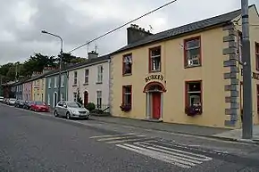
Banteer on the R579
References
- Google (18 December 2020). "R515 to R618" (Map). Google Maps. Google. Retrieved 18 December 2020.
- "S.I. No. 54/2012 – Roads Act 1993 (Classification of Regional Roads) Order 2012". Government of Ireland. 28 February 2012. Retrieved 18 December 2020.
This article is issued from Wikipedia. The text is licensed under Creative Commons - Attribution - Sharealike. Additional terms may apply for the media files.