Raaba
Raaba, also known as Raaba bei Graz, was a village, merged into Raaba-Grambach in 2015, in the province of the Austrian state of Styria and a suburb of Graz.
Raaba | |
|---|---|
 Coat of arms | |
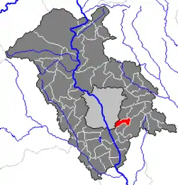 Location within Graz-Umgebung district | |
 Raaba Location within Austria | |
| Coordinates: 47°01′40″N 15°29′48″E | |
| Country | Austria |
| State | Styria |
| District | Graz-Umgebung |
| Government | |
| • Mayor | Josef Gangl (SPÖ) |
| Area | |
| • Total | 7.71 km2 (2.98 sq mi) |
| Elevation | 350 m (1,150 ft) |
| Population (2014-01-01) | |
| • Total | 2,268 |
| • Density | 290/km2 (760/sq mi) |
| Time zone | UTC+1 (CET) |
| • Summer (DST) | UTC+2 (CEST) |
| Postal code | 8074 |
| Area code | 0316 |
| Vehicle registration | GU |
| Website | www.raaba.at |
Due to its proximity to Graz an area with medium-rise office blocks has developed on the edge of Raaba.
Population
| Year | Pop. | ±% |
|---|---|---|
| 1869 | 625 | — |
| 1880 | 653 | +4.5% |
| 1890 | 681 | +4.3% |
| 1900 | 697 | +2.3% |
| 1910 | 755 | +8.3% |
| 1923 | 834 | +10.5% |
| 1934 | 848 | +1.7% |
| 1939 | 802 | −5.4% |
| 1951 | 893 | +11.3% |
| 1961 | 1,057 | +18.4% |
| 1971 | 1,211 | +14.6% |
| 1981 | 1,447 | +19.5% |
| 1991 | 1,720 | +18.9% |
| 2001 | 1,927 | +12.0% |
| 2014 | 2,268 | +17.7% |
References
This article is issued from Wikipedia. The text is licensed under Creative Commons - Attribution - Sharealike. Additional terms may apply for the media files.