Rajokri
Rajokri earlier known as "Harjokri" is a census town in New Delhi District (earlier in South West Delhi district) in the Indian union territory of Delhi. Rajokri village is near Gurgaon border on NH-8.This village is one of the oldest village in Delhi.This village was founded by King Anandpal
Rajokri
Harjokari | |
|---|---|
Urbanized Village | |
 Rajokri  Rajokri | |
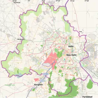
| Coordinates: 28.5031°N 77.11106°E | |
| Country | |
| State | Delhi |
| District | New Delhi |
| Founded by | Lala Dal chand |
| Population (2001) | |
| • Total | 12,758++ |
| Languages | |
| • Official | Hindi, English |
| Time zone | UTC+5:30 (IST) |
| Vehicle registration | DL9(vasant Vihar) |
| Website | Na |
Demographics
As of 2001 India census,[1] Rajokri had a population of 12,758. It is a major Yadav village and is a part of Ahirwal. Rajokri mainly consists of people having the Jhagdoliya gotra of the Yadav caste. There are many temples, But the most famous temples are Kholi Baba Temple and Lord Shiva Temple/Mahadev Mandir. There are 3 Banks, 13 ATMs,post office (inside Afs) warehouses for Nyka,Myntra,udaan,Naptol, 2 fuel station at outer side of village motel Mapple,IIT is just opened in 2019, Air Force Station, Kendriya Vidyalaya,Govt girls and boys schools junior governmentt schools and many Schools are now opened in Rajokri.
            It is the first village of New Delhi on NH-8 while coming from Gurgaon to Delhi. Acharya Narendra Dev College of Delhi University was opened in Rajokri, but could not function here due to some issues. http://andcollege.du.ac.in/?q=about. Rajokri houses luxurious and the most expensive farm houses in Delhi. The farm house schemes includes
The Green, Westend Greens, Grand Westend Greens etc.
Negative points - No public transport No ground ,no park, no police post, by govt
Unauthorized encroachment/construction is done daily basis in aravali ruined all the forests.
There are 12 brethren villages (11 of Yadavs and 1 of Jat) of which Rajokri is a part. These are Sarhol(Chief village of the Brethren), Rajokri, Kapashera, Dundahera, Molahera, Sikanderpur, Nathupur, Chakkarpur, Wazirabad, Kanhai, Badshahpur and Bijwasan.
References
- "Census of India 2001: Data from the 2001 Census, including cities, villages and towns (Provisional)". Census Commission of India. Archived from the original on 16 June 2004. Retrieved 1 November 2008.